Mangamate Hut
Whirinaki Te Pua-a-Tāne Conservation Park
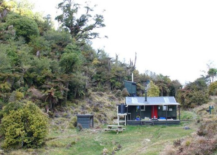
A comfortable little hut located on the saddle between the Kakanui and Mangamate Streams. There is a picnic table and ample grassy camping out front. The Mangamate Hut has been relocated to grid reference V18 306654 from a point about 2km north (V18 313675). The hut and track may be marked incorrectly on maps.
|
Owner
|
Owner: DOC |
|---|---|
|
Category
|
Standard Hut |
|
Sleeps
|
Sleeps 9
9
|
|
Facilities
|
Toilet, Enclosed wood/coal burner |
|
Water supply
|
Tap or tank water |
|
Getting there
|
Whirinaki Track from Central or Upper Whirinaki Huts, or from River Road car park. |
|---|---|
|
Unlocked
|
This hut is unlocked and open to access. |
|
Bookings
|
No bookings — open access
No — open access
|
|
Altitude
|
720m |
|---|---|
|
Mobile phone coverage
|
No coverage |
|
Maps
|
NZTopo50-BG38
|
ID 2434
About this hut
Added 19 November 2007 by matthewmatthew.
No revisions.
74 views in the past year (6 per month).