South Temple Hut
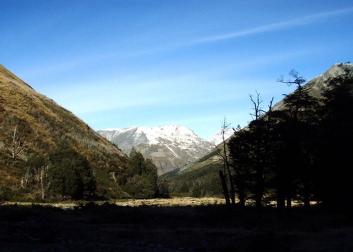
South Temple Hut (6 bunks, stove, firewood avail., tank water) is a pleasent 6-bunk tramping hut in the South Temple. It is located on a terrace just above the river, with beech forest upriver, and looking over small tussock flats around the river forks.
The track from the Temple roadend is of very high quality, and as such this hut makes a great overnight trip for any ability. Above the hut, four alpine routes continue over high rocky passes into the Ahuriri (Watson Stream), Ahuriri (Top Hut), Ahuriri/South Huxley Col and North Temple. These are all unmarked alpine routes, with passes snow-covered in winter, and scree-covered in summer - and as such require some experience. That said, they are exciting routes with beautiful views, and worth the effort. Many round trips are possible.
The Sth Huxley is accessible by following the Temple valley north from the hut to the pass into the Ahuriri, then sidling north to the V-Notch pass and descending to the Huxley.
|
Owner
|
Owner: DOC |
|---|---|
|
Category
|
Standard Hut |
|
Sleeps
|
Sleeps 6
6
|
|
Facilities
|
Toilet, Enclosed wood/coal burner |
|
Water supply
|
Tap or tank water |
|
Getting there
|
Temple roadend / Shelter: 7km, 1.5-3hrs, well maintained valley track Shamrock Hut (Ahuriri): 14km (5-10hrs) unmarked alpine route: valley SW of hut ->1900m col (G38 475662) ->Watson Stream ->Ahuriri Top Hut (Ahuriri): 11km, unmarked alpine route: valley W of hut ->col (G38 452719) Sth Huxley Biv: 14km, unmarked alpine route: Sth Temple ->1884m col (G38 458759) Nth Temple: 8km, unmarked alpine route: Sth temple ->1890m col between Belfry & Bruce Peak |
|---|---|
|
Unlocked
|
This hut is unlocked and open to access. |
|
Bookings
|
No bookings — open access
No — open access
|
|
Altitude
|
820m |
|---|---|
|
Mobile phone coverage
|
No coverage |
|
Maps
|
NZTopo50-BZ14
|