Frew Saddle Bivouac / Frew's Biv
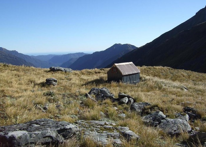
The Frew Saddle Bivouac (sleeps 2, matresses, stream water 100m distant, no fire) is a well maintained alpine bivouac 200m west of the Frew Saddle between the upper Hokitika and Whitcombe valleys. It's well above the treeline in rock & tussock (& speargrass) country. Resident kea provide entertainment.
The marked tracks from Poet Hut via homeward ridge, and Bluff Hut both peter out 3km below the Frew Saddle, and it's a riverbed walk from there. Plentiful speargrass adds to the fun. Poles start again on the Hokitika valley floor directly below the saddle and lead to the pass and hut.
The cut track to the saddle from the Whitcombe side is well maintained but hard going: it spends a long time sidling steep, slippery faces, climbing over tree roots, and finally as a riverbed route for the last 2.5km to the hut/pass. Allow at least twice the time you'd expect.
Hut book entries speak of possibilities for exploring the ridgeline south of the biv.
|
Owner
|
Owner: DOC |
|---|---|
|
Category
|
Basic Hut/Bivvy |
|
Sleeps
|
Sleeps 2
2
|
|
Facilities
|
None |
|
Water supply
|
Tap or tank water |
|
Getting there
|
Toaroha Roadend (J33 577094): 31km - Cut track & poled route. Frew Biv -> Poet Hut via Homeward Ridge (10.5km, 5-8 hrs) -> Toaroha Biv (2.5km, 1-1.5hrs) -> Top Toaroha Hut (2km) -> Cedar Flats Hut (7km) -> roadend (9km) Whitcombe roadend (J33 482038): 23km. Biv -> Frew Hut (7km, 3-6hrs) -> Rapid Ck Hut (7km) -> roadend (9km) Raikaia Valley (Louper Biv): 36km. Biv-> Frews Hut (7km, 3-6hrs) -> Prices Hut (9km, 3.5-7hrs) -> Neave Hut (9km, 4-8hrs) -> Louper Biv (11km, 5-9 hrs) |
|---|---|
|
Unlocked
|
This hut is unlocked and open to access. |
|
Bookings
|
No bookings — open access
No — open access
|
|
Altitude
|
1,308m |
|---|---|
|
Mobile phone coverage
|
No coverage |
|
Maps
|
NZTopo50-BV19
|