
Auckland Council's Environment and Community Committee decided 10 April to close public access in response to Kauri Dieback Disease. Forested areas will be closed, while beaches and pasture lands will remain open. Some closures will also occur in the Hunua Ranges. The closures will be backed by a Controlled Area Notice under the Biosecurity Act.
The Waitākere Ranges are already subject to a rāhui (customary closure) established four months ago by local iwi, Te Kawerau ā Maki. The iwi called on Auckland Council at the time to establish a biosecurity Controlled Area.
Auckland Counciller, Penny Hulse commented on Radio NZ Morning Report: "Areas that are permanently closed, that will be intergenerational. There are parts of the Waitākere ranges that will be off limits for my lifetime."
Staff are now beginning to decommission tracks and remove signage from the Waitākere Ranges Regional Park.
Once surface improvements and rerouting is undertaken, some tracks will be reopened. The Hillary Trail is affected by the closure, but will be a priority for reopening.
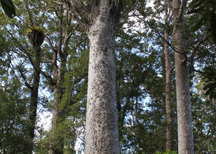
Kauri Dieback is caused by a soil pathogen and infects kauri roots and has been found to be spread by humans. The Waitākere Ranges are the most heavily infected area recorded in the country with over 18% of trees found to be infected in 2016.
Waitākere Ranges Closures (updated 4 May)
The following tracks remain open. All others are closed.
- Anawhata Beach Track
- Arataki Nature Trail (upper loop only) (newly opened)
- Cave Rock Track
- Exhibition Drive Walk
- Huia Dam Road (to dam only)
- Ian Wells Track (partial)
- Kakamatua Beach Walk
- Laird Thompson Track
- Lake Wainamu Track
- Large Kauri Walk
- Lion Rock Track
- Long Road Track (partial - from road end to where paddock meets forest)
- Lookout Track (Arataki Visitor Centre)
- Manukau Timber Co Heritage Walk
- Marawhara Track
- McLachlan Monument Track
- Mercer Bay Loop Track
- Parker Track (newly opened)
- Pipeline Road and part of Pipeline Track
- Pohutukawa Glade Walk
- Rose Track
- Spraggs Monument Track
- Taraire Track (to falls only)
- Tasman Lookout Track
- Te Henga Walkway
- Upper Nihotupu Dam Road and Upper Nihotupu Walk
- Waitakere Dam Walk
- Whatipu Caves Track
The following campsites are now closed.
- Odlins 2
- Opanuku Pipeline
- Whatipu Caves
- Pararaha Valley
Other campsites remain open for now.
Hunua Ranges Closures
The following tracks are closed.
- Cossey Wairoa Track
- Whakatiwai Ridge Track
- Whakatiwai Road Track
- Lower Workman Track
- Mangatangi Trig Track
- Waharau Ridge Track
- Mangatangi Ridge Track
- Lower Link Track
- Upper Link Track
- Lower Mangatawhiri Track
- Kohukohunui Track - partial closure on the eastern side from Kohukohunui Trig Track junction.
The following campsites are closed.
- Mangatangi Trig
- Workman
- Thousand (1000) Acres
- Adam's Lookout
Further information
- Waitākere Rāhui, Te Kawerau ā Maki media release, 30 November 2017
- Waitakere Ranges closed, pigs culled to stop kauri dieback, Radio NZ Morning Report, 10 April 2018 (audio)
- Waitākere Ranges forests to close 1 May, Auckland Council media release, 10 April 2018
- Keep Kauri Standing, Kia Toitu He Kauri