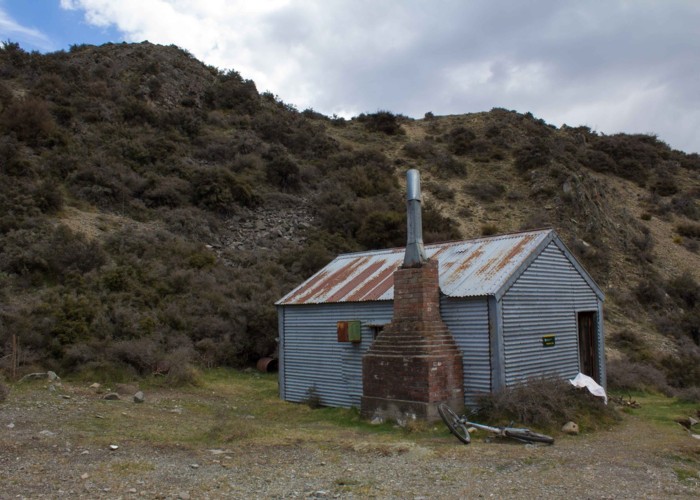
Manuka Hut via Lake Emily
Hakatere Conservation Park
- 3 hr 20 min return by the same track
- Easy
A short walk to a hut at the foot of the Mount Somers Range.
3 members favourited
1 member checked in
|
Walking time
|
3 hr 20 min |
|---|---|
|
Distance
|
14.0km |
|
Type
|
Return by the same track
|
|
Grade
|
Easy
The route is marked with poles. At points, there is no ground trail. Grades explained
|
|
Bookings
|
No bookings — open access
No — open access
|
|
Starts
|
Hakatere Heron Road, Ashburton Lakes. Turn off at Castleridge Station (marked as Te Araroa). A short dirt road leads to a car park and gate. |
|---|---|
|
Ends
|
Manuka Hut |
|
Maps
|
NZTopo50-BX19
|
|
Altitude
|
640m
–
800m
Altitude change 160m
|
ID 13465
About this track
77 views in the past year (6 per month).