Manuka Hut via Lake Emily
Hakatere Conservation Park
- 3 hr 20 min return by the same track
- Easy
- Castleridge Station car park to Lake Emily (land boundary): 30 minutes
- Lake Emily to Stour Track junction: 15 minutes
- Stour Track Junction to Stour River junction: 30 minutes
- Stour River Junction to Manuka Hut: 30 minutes
A short walk to a hut at the foot of the Mount Somers Range.
|
Walking time
|
3 hr 20 min |
|---|---|
|
Distance
|
14.0km |
|
Type
|
Return by the same track
|
|
Grade
|
Easy
The route is marked with poles. At points, there is no ground trail. Grades explained
|
|
Bookings
|
No bookings — open access
No — open access
|
|
Starts
|
Hakatere Heron Road, Ashburton Lakes. Turn off at Castleridge Station (marked as Te Araroa). A short dirt road leads to a car park and gate. |
|---|---|
|
Ends
|
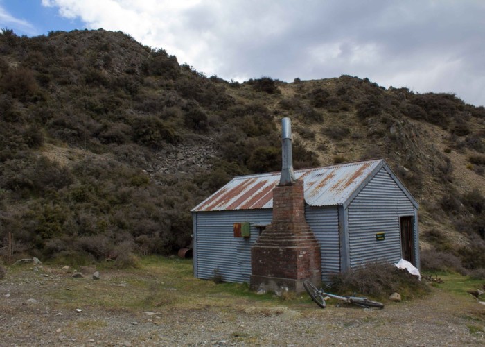
Manuka Hut |
|
Maps
|
NZTopo50-BX19
|
|
Altitude
|
640m
–
800m
Altitude change 160m
|
This walk is a straightforward journey over tussock flats and hills, and would be an ideal introduction to tramping. This route is there-and-back from Castleridge Station, but another alternative would be to continue on to Double Hut and Lake Heron, then return down the road by mountain bike. This route is part of the Te Araroa Trail.
Take the Ashburton Gorge Road inland from Mount Somers and turn off at Hakatere. Castleridge Station is just beyond Maori Lakes: look for the "Te Araroa" signpost here indicating a short side road. Follow it to a gate and car parking area.
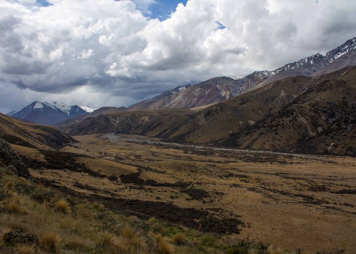
Beyond the gate, a muddy 4WD track climbs onto a hillside overlooking the wetlands of Emily Stream. Poles mark the route over a gentle saddle decorated with tussock and speargrass. This section is entirely across private land so keep on trail.
The trail soon bends down onto broad flats and passes through a gate within view of the circular Lake Emily. This gate marks the boundary of Hakatere Conservation Area, which includes much of the Clent Hills, and butts up against the Hakatere Conservation Park.
Beyond the lake, the vehicle trail climbs gently and begins to head off down the Stour River. A poled route turns off here and set out onto the tussocky hillside. It's an easy climb above the flats on a largely unformed route through tussock, speargrass, matagouri, and celmisia daisies.
Over a low ridge, the poles mark a quick descent to matagouri flats by the Stour River West Branch. Another vehicle track leads up the river.The hillside on the right is the low Manuka Range, which ends at a nearby hook in the river. Head up to this bend by Manuka Lake. Another junction here, and the hut is just a few minutes off to the right, upriver.
Walking times:
Note that this route is open to mountain bikers, with a short detour down the Stour Track and back up the Stour River to avoid the ridge (section 3 above).