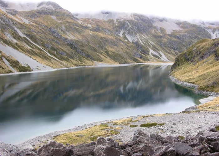
Blue Lake
- 2 – 4 days return via same track
- Easy/medium
Blue Lake is a small, pretty lake dammed by boulders at the head of the Sabine Valley. Beyond is Lake Constance and Waiau Pass. This track is avalanche-prone in winter and spring after snowfall or rain.
|
Walking time
|
2 – 4 days
16 hr
|
|---|---|
|
Distance
|
42.0km |
|
Type
|
Return via same track
|
|
Grade
|
Easy/medium |
|
Bookings
|
No bookings — open access
No — open access
|
|
Starts
|
Sabine Hut, Lake Rotoroa |
|---|---|
|
Maps
|
NZTopo50-BS24
|
|
Altitude
|
450m
–
1,190m
Altitude change 740m
|
Water taxi transport is available across the lake. This cuts a day's tedious walk in either direction. The times here assume water transport is used. Radios are available in Sabine Hut for calling the taxi.
From Sabine Hut, the track crosses forested river flats before entering the valley at a the strikingly deep and pretty Sabine River Gorge. This is spanned by a bridge after 40 minutes, switching the track to the true left bank. From here, the Sabine-D'Urville Track leads off to D'Urville Hut. Continuing up the valley, the track meanders through handsome beech forest and crosses regular grassy flats.
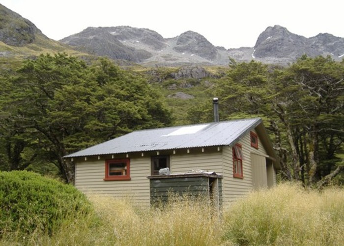
About 3.5 hours from Sabine Hut, the track begins to cross a series of avalanche chutes descending from the crags of the Mahanga Range. Beyond here, the river becomes very rocky, and the distinct shape of Mount Franklin appears ahead. The West Sabine Hut is located across a bridge on the true right bank at the foot of this ridge. This is the point where the Travers-Sabine Track meets up from the east.
Beyond here, the track continues on the true left through mossy forest, and breaks into the open after about 2.5 hours. Look for cairns near a large rock at the bottom edge of the scree that indicate where the track recommences in forest. The track soon breaks into the open again, crossing shattered rocks and shredded branches. It crosses the unnamed creek that descends from near Moss Pass. When rivers are up, this is the only potentially hazardous river crossing. Views are dramatic in all directions with waterfalls cascading down at various points.
The track follows the river bank as it curves to an impressive tumbling cataract. Beyond, the river becomes a very pretty mossy stream, before a final climb into light forest leads to the hut by Blue Lake.
The lake itself is small but very pretty and very cold, with a distinct blue colour visible in its depths. There are several interesting campsites around the lake, and the area around the head of the lake is particularly pretty.
Lake Constance is a worthwhile walk from here. Take the Waiau Pass route on up the valley over tussock then light forest. After climbing the ancient scree dam that confines Lake Constance, views of the valley up to Waiau Pass are attained. Cut off the track leftward across the rubble to a steep rocky descent to the lake, which has no visible outlet. Allow about 1.5 hours for the return trip to Lake Constance.