Nearby
emergency shower
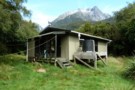
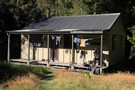
McKerrow Island Hut
Photograph
•
Distance: less than 100m away
basic hut with "emergency shower" (dip in the lake)
More ▶︎
McKerrow Island Hut
Hut
•
Standard Hut (DOC). Capacity: 12.
•
Distance: 109m away
Alternative hut located at the head of Lake McKerrow on the Hollyford Track. The hut is located on an island, ...
More ▶︎
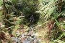
McKerrow Island ford
Photograph
•
Distance: 1.0km away
Crossing site to reach McKerrow Island. Not very passible with the Hollyford river in flood!
More ▶︎
Demon Trail Hut
Hut
•
Serviced Hut (DOC). Capacity: 12.
•
Distance: 2.7km away
Demon Trail Hut (serviced, 12 bunks, stove, firewood) marks the southern end of the infamous Demon Trail. Between the Hollyford ...
More ▶︎
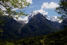
View from Lake Alabaster
Photograph
•
Distance: 4.2km away
mountain shot from Lake Alabaster
More ▶︎
Big Bay - Pyke - Hollyford Road-end Route
GPX file
•
Distance: 6.8km away
Big Bay - Pyke - Hollyford Road-end Route as tramped by us in May 2012 and recorded with Garmin GPS60csx
More ▶︎
Pyke - Big Bay Route
Track
•
3 – 4 days. Hard. One way.
•
Distance: 6.9km away
A more challenging extension to the Hollyford Track following old roads, rivers, lake edges, and beaches.
More ▶︎
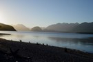
Lake Alabaster from the South
Photograph
•
Distance: 7.1km away
Taken from the beach about 5 minutes from the Lake Alabaster hut.
More ▶︎
Lake Alabaster Hut
Hut
•
Serviced Hut (DOC). Capacity: 26.
•
Distance: 7.1km away
Second hut on the Hollyford Track.
More ▶︎
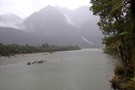
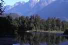
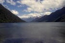
Lake McKerrow, Hollyford Valley
Photograph
•
Distance: 7.7km away
Lake McKerrow, Hollyford Valley viewed from North end of lake
More ▶︎
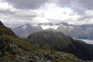
The tops of the Darran Mountains - Fjordland NZ
Photograph
•
Distance: 9.1km away
The exit from the Lake Nerine basin when heading to North Col overlooks the lower end of Hidden Falls Ck ...
More ▶︎
Mt Tutoko, Hollyford Valley
Photograph
•
Distance: 9.4km away
Mt Tutoko from Hollyford Valley
More ▶︎
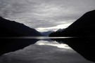
Lake Alabaster from the North
Photograph
•
Distance: 9.5km away
Taken from the Northern head of the lake looking South. 3 hours of wading in the lake awaits to reach ...
More ▶︎