
Back in the late 1890s, local Puramahoi farmer John Flowers drove one thousand sheep in single file to Boulder Lake. Assisted by about ten men and their dogs, this was a three-day journey, camping at a couple of water holes along the way. The annual Boulder Lake muster lasted about 3 decades, but today the burnt-off hills are cloaked with regenerating scrub. There is scant evidence of any stock track remaining, however, a few parties make this strenuous trip each year into the wild heart of northern Kahurangi.
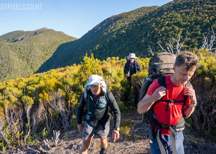
Day 1 uses the steep marked track up to Parapara Peak, a popular 1200m climb that takes most parties 5 hours. This track begins at the Intentions Booth at the end of Ward-Holmes Rd. A knee-deep crossing of the Pariwhakaoho River means your socks and boots may be wet from the start.
After 10 minutes following a farm track along the river bank, enter the dank bush where a muddy trail climbs above Copperstain Creek. In the 1960s a mining scheme tried to extract copper sulphide from these rocks, but northern rata and mamaku have removed all traces of their efforts. After splashing up this creek, a series of switchbacks enables you to gain some serious altitude on to a prominent ridgeline cloaked in an understorey of kamahi, quintinia and mingimingi.
Clamber up a steep staircase of roots on to Goat Hill. As the gradient eases, enter the original mixed beech and podocarp forest. Higher up, pass through mountain neinei and notice marble outcrops featuring white quartz. Topping out above the treeline, look out for a white memorial cross on your right. This is where the ashes of John North were scattered in 1957. He and his mate were obsessed in their fruitless search for a ‘lost reef’ of gold-bearing quartz in this vicinity.
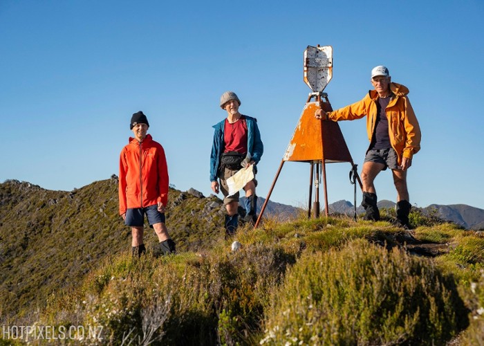
Enter an empty clearing where a solitary steel waratah has been bent over by the wind. You can fetch water from the rain tank of a locked 2-bunk DOC staff hut. This is located 200m south of the clearing. From the waratah, an obvious ground trail perambulates along pleasant tussock tops on an undulating ridgeline that rises to Parapara Peak (1249m) and the trig station beyond. Enjoy unrivalled views of Farewell Spit, the Aorere Valley and the Anatoki Range.
From the DOC hut, look out for pink ribbons hanging from foliage which lead south into a bush saddle, then up onto Walker Ridge, cloaked in totara and dracophyllum. After a couple of hours good going, the ground trail evaporates at a row of red pickets (stakes).
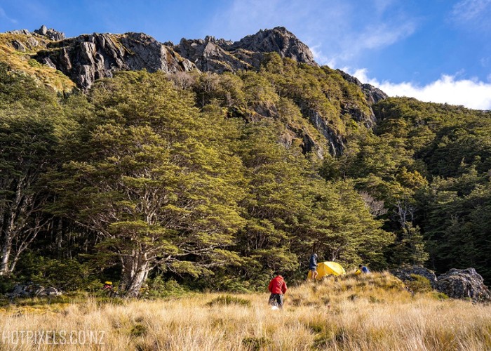
The next stage along Walker Ridge involves bashing through thick, regen bush, at a snail’s pace. Ironically, you will see many discarded Powelliphanta shells. About halfway along the ridge, turn right. Follow a compass bearing down a valley wall to Cedar Saddle. There is pleasant camping here, beneath towering mountain cedar and flowering red rata, serenaded by birdsong. Fetch water from a tiny tributary of the Slate River. This is critical during hot summer months, as there is no water (or snow) along the tops.
The gruelling 350m climb out of Cedar Saddle is tough, and involves pushing through scratchy manuka. After 3-4 hours, locate a large cairn made of white quartz on spot height 1264. From there drop sharply down a spur to The Devils Dip, a bush saddle with good camping potential. Also known as Crosscut, it took the mob of sheep 2 hours to pass through this incision in the ridgeline.
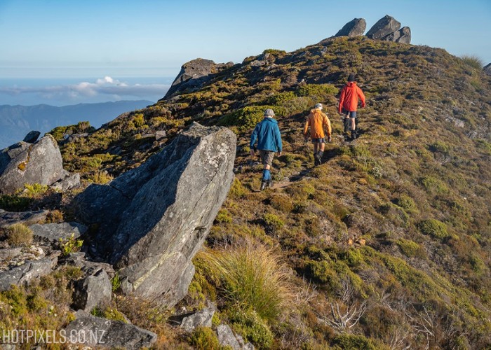
The stiff climb out of the saddle up a spur has been cut in recent years and marked with a bit of pink tape. Three hours of concerted effort puts you on the open tops of Haupiri Range with a grandstand view of Golden Bay. Listen for kea and look out for pipits frolicking on shattered shale.
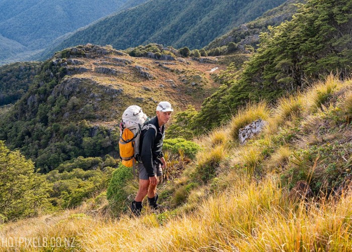
Travel is easy along a grassy ridgeline punctuated with numerous knobs. The scramble up Mt Christmas (1539m) is straight-forward, but the descent down unstable scree needs care. The sloping apex of Paradise Peak (1549m) is also straight-forward, up snowgrass terraces to the summit. The descent on the west side is along a series of narrow ledges.
From this vantage you get unsurpassed views along the spine of the Douglas Range to the Dragons Teeth in the sprawling sea of muscular mountains.
From the western end of the col just prior to Slate River Peak, descend a grassy slope and rock slide to reach the tarns of Paradise Basin to the south of this peak. This beautiful clearing is a special spot where the kea and goat population outnumber humans. Water is sourced from a nearby stream.
Return to the ridgeline by threading through beech forest and by climbing up a tongue of tussock. You will reach a saddle to the west of Slate River Peak (1527m).
Further west you will see the lie of the land. A bare ridgeline arcs in a dress circle along to Brown Cow, cradling the catchment of Snow River below. Drop into these headwaters if you’re out of H2O.
Punch through a bush saddle where remnants of wire netting are evidence of the sheep musters. A tedious plod up gentle tussock slopes gains Caesar Knob (1449m). From this summit, the abrupt descent route down to Boulder Lake is obvious. However, the intial descent is a zig-zag down ball-bearing scree and requires care. At the end of a finger-like spur, locate a big cairn, a second cairn, then veer to the right. Our party placed a third cairn well off the ridge at the 1120m contour. Head NW down a spur on gravel pans. Push through dracophyllum and beech trees. At a large beech tree, veer left toward an indentation in Boulder Lake, a small bay. From the shoreline, the hut is 500m SW.
Boulder Lake Hut has 8 bunks, a sunny verandah and a woodstove. Water is obtained from Suspicion Creek nearby, which has the ultimate natural spa pool beneath a picturesque waterfall. The old tin shed near the longdrop was the original hut, built by the Golden Bay Alpine and Tramping Club in 1962.
A worthy side-trip is visiting the lake outlet. Follow the shoreline track anticlockwise around the lake. Leave the track at Kiwi Creek through copses of scrub, around to where the lake outflow falls over a 64-metre drop into a hidden ravine. The remains of a man-made dam are still evident, along with bits of No.8 wire. Completed in 1899, this three-metre dam doubled the lake’s storage capacity. The water was fed through 8km of fluming down to the gold sluicing claim below. This enterprise failed spectacularly, and in 1920 Sid Flowers destroyed the dam with dynamite to reclaim his family grazing flats around the shoreline. During the Depression years, a new influx of miners shot his sheep for sport, so the man despaired, and eventually quit. The burnt hillsides of Haupiri Station were abandoned to return to their natural state.
At the northern end of Boulder Lake, a rocky track climbs over a high shoulder on Brown Cow (1452m) before dropping down scree slopes marked with poles. Through Cow Saddle, sidle below The Pulpit then traipse over a row of un-named knobs. Past Beathams Clearing and Black Cow, this old track is in no hurry to lose altitude. At the limestone rock formations known as The Castles, take care crossing 13 deep crevasses. Long ago, each of these gaping holes were bridged.
At a signed junction, turn right along the original route on a bulldozed farm road. An expansive view of Aorere Valley can be enjoyed from Lookout Knob, before the trail swings north. A relentlessly nice avenue through regenerating ti tree allows for steady progress downhill, although the hard clay surface is tough on swollen feet. After 9-10 hours (22km), you will emerge through a paddock to the carpark at James Road.
Access 12km from Takaka, take Ward-Holmes Rd to trackhead.
Grade Difficult
Distance 53km
Total Ascent 3770m
Time 5–6 days, (40 hrs)
Topo50 maps BN23, BN24, BP23, BP24.
Accommodation Boulder Lake Hut (8
