Molesworth Recreation Reserve
An iconic high country station located behind the Kaikoura Ranges.
Molesworth station is New Zealand's largest farm at 1800 square kilometers, with the largest head of cattle, up to 10000. Several stations in the area failed during the early twentieth century as they became plagued with rabbit. The Crown purchased these stations and added them to Molesworth. In 2005, land administration passed to the Department of Conservation. The farm is now run as a recreation reserve, with 30% of the land kept free of cattle.
The station is bordered by the St James and Rainbow Conservation Areas in the west, Leatham Conservation Area in the north, Hanmer Forest Park in the south, and the Ka Whata Tu o Rakihouia / Clarence Conservation Park in the east.
Highlights
- Acheron Road, a 207km road open to regular cars and mountain bikes.
- The Hanmer - St Arnaud / Rainbow Road, 112km and suitable for high clearance 4WDs or mountain bikes.
- East West Route, a 5-6 day, 115km unmarked tramping route from the Inland Kaikoura Road through to the Acheron Road.
- Leatham Molesworth Loop, a 4-5 day, 56km circuit.
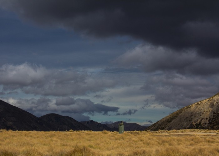
- Camp by Molesworth Cob Cottage, built 1866 by John Murphy, or Acheron Accommodation House, built 1862 by Ned James.
Molesworth by road
Two main roads run through the station, providing options for cars, mountain bikes, and 4WD vehicles.
- The Acheron Road is open from Labour Weekend to Easter and is suitable for regular cars. It runs from Blenheim to Hanmer Springs: 5-6 hours driving, 207km.
- The Rainbow Road is divided into three sections. The southern section, Tophouse Road is open year-round and suitable for regular cars. The middle section, Wairau Hanmer Springs Hydro Road is open year-round but suitable for high suspension 4WDs only. Beyond Molesworth, the Wairau Hanmer Springs Hydro Road crosses into Rainbow Station at a locked gate. This gate is open 26 December to Easter. Tolls are charged on this road: vehicles $25, motorbikes $15, mountain bikes $2, and walkers free of charge. 3 hours driving, 112km.
Managed public access
Molesworth is divided into four public access zones.
- Land south of Acheron Accommodation House and land in the west along the Clarence River, up to and beyond Sedgemere Sleepout is open all year.
- Land at the eastern edge is open November to April.
- Land at the northern edge on the Leatham Molesworth Loop is open May to December.
- Walkers on the Saxton River must travel north so as not to drive stock out of the valley.
- Access to the central area around the Acheron Road requires an activity permit -- unless simply travelling the Acheron Road.
- Acheron Road is locked at Acheron Accommodation house in the south and Molesworth Cob Cottage in the north. It is open between Labour Weekend and Easter.
How to get there
From Hanmer Springs, both the Clarence Valley Roads over Jacks Pass and Jollies Pass Roads leads into the Molesworth. although Jollies Pass is not suitable for regular cars. In the west,the 4WD-only Tophouse Road continues up the edge of the station, becoming Wairau Hanmer Springs Hydro Road, to connect with the private Rainbow Road and come out at St Arnaud. Further east, the Acheron Road leads past Molesworth Cob Cottage, exiting at Blenheim.
Walking access is available from the Clarence River over the Seaward Kaikoura Range via Blind Saddle. Walking access is also available from neighbouring Leatham Conservation Area along the Severn River.
Where to stay
Campsites on the Acheron Road are located at Molesworth Cob Cottage and Acheron Accommodation House. Camping is not permitted elsewhere.
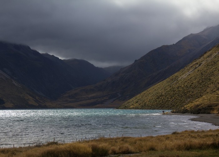
Campsites on the Hanmer - St Arnaud Road are located at Lake Tennyson, Coldwater Creek, and Sedgemere. Island Gully and Sedgemere Huts are also available.
Away from roads, camping is permitted anywhere that is open to the public. Severn, Saxton, Lake McRae Huts and Elliot Bivvy are all available for use.
The basics
- Entrance fee: there are no entrance fees. Note that the Hanmer - St Arnaud Road north of Molesworth is a toll road.
- Pets: dogs and pets are not allowed in the conservation reserve without a permit.
- Vehicles: cars should remain on formed roads and should carry full size spare wheels. The Acheron Road is suitable for regular cars. Mountain bikes are permitted on roads and marked routes. All gates should be left as found.
- Overnight camping and walking: no fees, registration, or restrictions for the backcountry. Fees are associated with hut use and established campsites.
- DOC Marlborough has 24-hour Acheron Road information. Telephone (03) 572 9100. Rainbow Road information is available from Lone Star Farms at http://www.lonestarfarms.co.nz/rainbow-access/ .
Hazards
- The tramping routes are unmarked, requiring high levels of experience and fitness. Freezing conditions, flooded streams, and reduced visibility due to mist can occur at any time of year.
- There is no mobile phone coverage or vehicle support facilities within the reserve.
- Vehicles should carry full size spare wheels, not "Space Savers" as these are unsuitable for the roads.
Visitor information
Kaikoura Visitor Centre
West End, Kaikoura
+64 3 319 5641
Full contact details
Wairau / Renwick Office
Gee Street, Renwick
+64 3 572 9100
Full contact details
|
Area
|
1,808 square kilometres |
|---|---|
|
Established
|
7 January 2005 |
|
Maps
|
NZTopo50-BS26
NZTopo50-BS25 NZTopo50-BT24 NZTopo50-BT27 NZTopo50-BT25 NZTopo50-BS24 |