Hooker Valley Track
- 4 hr return by the same track
- Easy
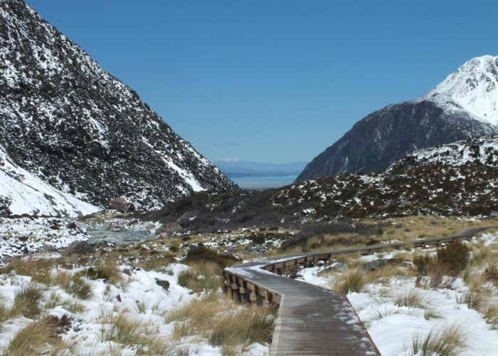
Mostly flat, easy and touristy track along the Hooker River from White Horse campground to the Hooker Glacier. Great views.
3 members favourited
2 members checked in
|
Walking time
|
4 hr |
|---|---|
|
Distance
|
4.5km |
|
Type
|
Return by the same track
|
|
Grade
|
Easy
All crossings are bridged, may get snow but easy and flat, no worries. Wet after fresh snow. Grades explained
|
|
Bookings
|
No bookings — open access
No — open access
|
|
Starts
|
White horse campground, Aoraki Mt Cook National Park |
|---|---|
|
Ends
|
Hooker Lake |
|
Maps
|
-
|
|
Altitude
|
900m
–
970m
Altitude change 70m
|
|
Link
|
www.doc.govt.nz/parks-and-recreation/tracks-and-walks/canterbury/aoraki-mount-cook/aoraki-mount-cook-village-walking-tracks/http://www.doc.govt.nz/parks-and-recreation/tracks-and-walks/canterbury/aoraki-mount-cook/aoraki-mount-cook-village-walking-tracks/ |
|---|
ID 8834
About this track
40 views in the past year (3 per month).