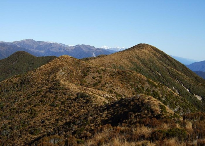
Looking SW along the Bald Hill Range June 2013

This photo shows the easy tussock tops of the Bald Hill Range. Bald Hill is the tussocky high point down the range. Bald Hill has a metal trig beacon on it that doesn't show up in this photo.
Beyond the Bald Hill Range you look over the Hitchen Range which runs between the Little Waitaha and Waitaha Rivers toward the Mount Cook region. The high snow clad peaks from right to left are Tasman, Cook, the Minarets and Elie de Beaumont if my identification is correct.
Whilst the tussock & sparse scrub of the Bald Hill Range is easy going getting up through the tall bush & thicker scrub is a challenge because currently there are no maintained tracks. Overgrown tracks access the range from Douglas Saddle (Explorer hut), from Mikonui Flat and from the Totara Valley.
The map pointer is on Bald Hill not the location where I took the photo from.
Comments
-
 glennj Both tracks ok March 2017.
21 March 2017
 -
 glennj An overgrown hunters track from Explorer Hut to Fraser Peak and an old miners/hunters track that goes up to the Bald Hill tops from the Totara Valley Road have been roughly opened up in places since I wrote the caption for this photo in 2013. Thus access to the Bald Hill Range is a bit easier now than it was in 2013 but bear in mind neither track has been opened all the way thru to Bald Hill and some sections remain challenging.
18 September 2016