Mount Grey & Red Beech loop
- 1 day loop track
- Medium
Loop up to Mt Grey summit from the picnic area / carpark (not Lake Janet) and back via Red Beech Track.
5 members favourited
8 members checked in
|
Walking time
|
1 day
6 hr 30 min – 9 hr
|
|---|---|
|
Distance
|
15.5km |
|
Type
|
Loop track
|
|
Grade
|
Medium
One river crossing, one ford crossing, many trees across track, muddy Grades explained
|
|
Bookings
|
No bookings — open access
No — open access
|
|
Starts
|
Mt Grey picnic area |
|---|---|
|
Maps
|
NZTopo50-BV23
NZTopo50-BW23 |
|
Altitude
|
260m
–
933m
Altitude change 673m
|
You can walk this loop clockwise but DOC brochure recommended counterclockwise due to steep scree slope north of the Mt Grey summit which would be difficult to ascend.
Mostly native beech forest but there is one section of pine and gorse on the ascent up the Mt Grey Track.
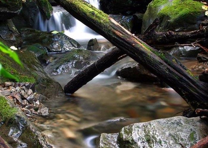
Ford crossing between trailheads near picnic area plus one river crossing on Red Beech Track which I made across on rocks and logs but depending on flow, you might have to get your feet wet.
Was quite a bit of windblown debris and trees lying across the track when I did this on 26 August 2012.
There are two geocaches along this trail.
ID 8166
About this track
Added 27 August 2012 by NathanaelBNathanaelB.
4 revisions, most recently 27 August 2012 by
NathanaelBNathanaelB.
149 views in the past year (12 per month).