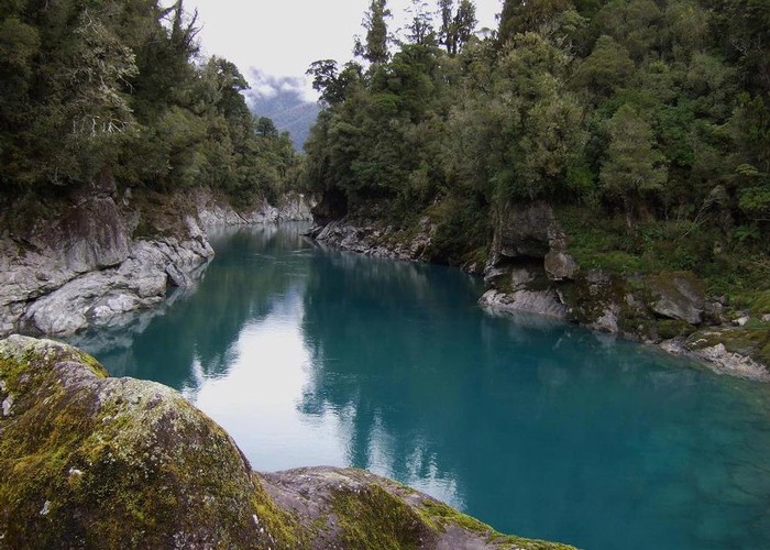
Hokitika River (Bottom Gorge)

This photo looks upstream from 5 minutes above the swingbridge at the Hokitika Gorge. (The furthest downstream & closest to the roadend of all the gorges on the Hokitika River)
The water levels are lower than normal but the bluish water colour is typical.
Most people are aware of the "tourist" track to the swingbridge over the gorge but few are aware that by continuing beyond the maintained track there is an unmaintained track/route that continues. Half a day or longer of bush & water course travel from the Hoki Gorge can take you to the relatively remote Explorer hut. This is achieved by heading up the TL of the Hoki, crossing Murray Saddle, then following Doctor Creek up to Douglas Saddle where the hut is situated.
Comments
-
machart Ive done a circuit throught there
27 October 2021
ID 7921
About this photograph
License
All rights reserved
23 views in the past year (2 per month).
