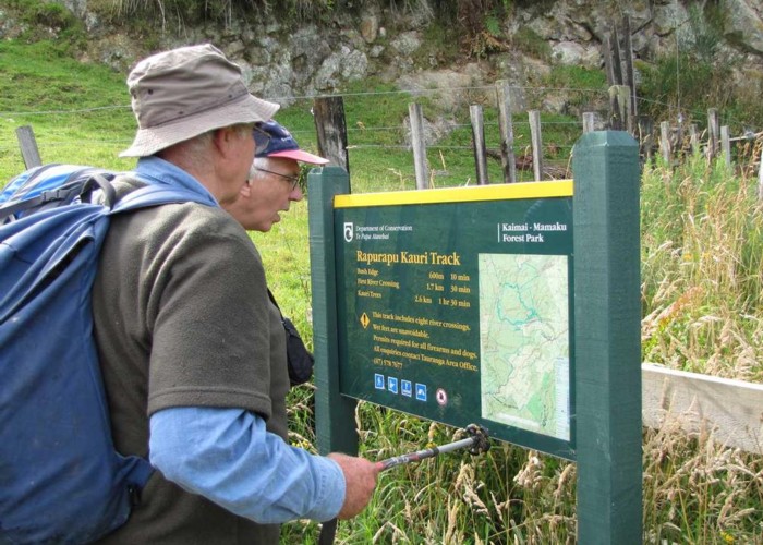
Rapurapu Kauris Track
Kaimai-Mamaku Forest Park
- 3 hr – 4 hr return via same track
- Easy
An easy half day return trip to 3 Kauri Trees. The main challenge is eight crossings of the stream
|
Walking time
|
3 hr – 4 hr |
|---|---|
|
Distance
|
6.4km |
|
Type
|
Return via same track
|
|
Grade
|
Easy |
|
Bookings
|
No bookings — open access
No — open access
|
|
Starts
|
Off state highway 29 |
|---|---|
|
Maps
|
NZTopo50-BD36
NZTopo50-BE36 |
|
Altitude
|
201m
–
296m
Altitude change 95m
|
This track starts on the Matamata side of the Kaimai Summit. It is indicated by a finger sign that says "Walking Tracks"
The track proceeds along an old 4 wheel drive track through reverting farmland before getting to the bush after about 600m. It climbs gently to a bush saddle before droping into the Rapurapu Stream. The stream has to be crossed eight times and the sign at the beginning of the track suggests that wet feet is inevitable.
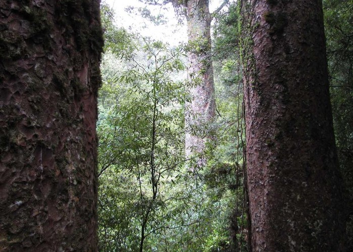
After the eighth crossing the track soon arrives at the foot of a wooden stair construction. This leads to a small platform next to two Kauri Trees. A third Kauri can be viewed between these trees.
Return to the car by the same route that you came in.