Omanawanui Track
Waitakere Ranges Regional Park
- 1 hr – 2 hr 30 min one way
- Easy
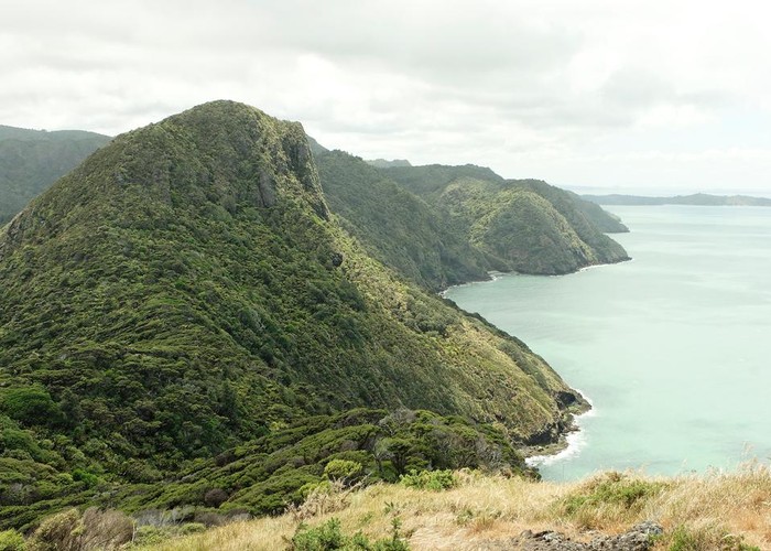
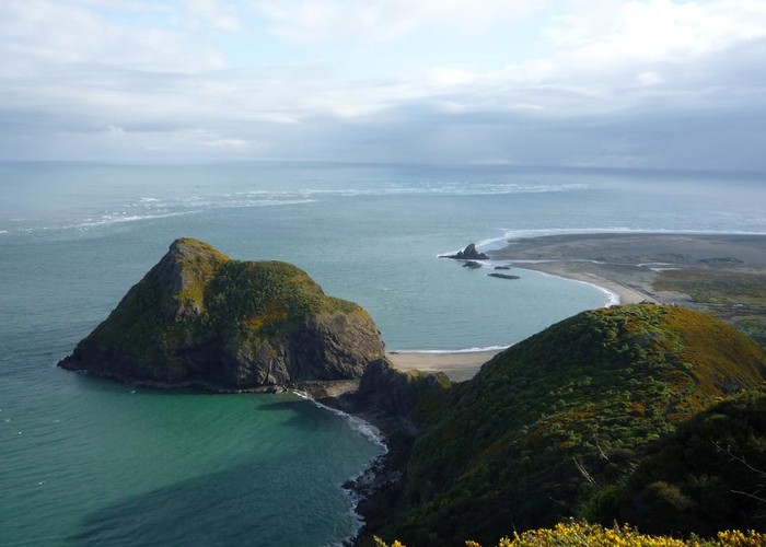
Omanawanui is the best track in the whole of the Waitakere Ranges with fantastic views of the Manukau Harbour and Auckland City, Awhitu Peninsula, and Whatipu Beach. Almost never gets muddy underfoot.
|
Walking time
|
1 hr – 2 hr 30 min |
|---|---|
|
Distance
|
3.0km |
|
Type
|
One way
|
|
Grade
|
Easy |
|
Bookings
|
No bookings — open access
No — open access
|
|
Starts
|
Summit of Whatipu Road, opposite Puriri Ridge Track. Only room for 2 or 3 cars here; alternatively start from Whatipu Beach |
|---|---|
|
Ends
|
Whatipu Beach carpark |
|
Maps
|
NZTopo50-BB30
|
|
Altitude
|
Sea level
–
241m
Altitude change 241m
|
From the the top of Whatipu Road the track follows a gently undulating ridge to meet up with the road about 10 minutes later. The track continues along the rocky ridge, passing some steep drops and climbing over a couple of high points. Some steep climbs and descents, particularly west of the trig at point 241. From the last high point the track swings north and descends into Whatipu.
Doing Omanawanui in conjunction with the Kura track makes a good loop walk of around 4 hours. Recommend doing the loop clockwise to come down Omanawanui.
This track is now part of the Hillary Trail.