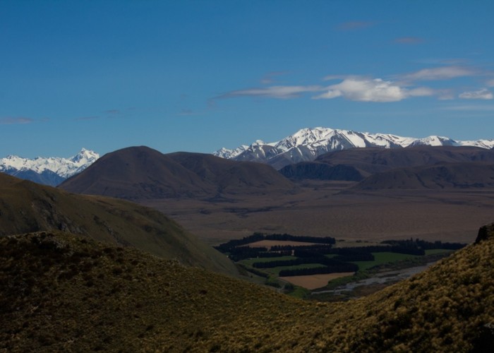
Mt Barrosa
Hakatere Conservation Park
- 6 hr – 3 hr return via same track
- Medium
Isolated 1364m mountain of volcanic origin on Clent Hills in new Hakatere Conservation Area.
|
Walking time
|
1 day
6 hr – 3 hr
|
|---|---|
|
Distance
|
3.3km |
|
Type
|
Return via same track
|
|
Grade
|
Medium
Marker poles not always visible in clag Grades explained
|
|
Bookings
|
No bookings — open access
No — open access
|
|
Starts
|
Carpark 500m down from Blowing Point |
|---|---|
|
Ends
|
summit of Mt Barrosa |
|
Maps
|
NZTopo50-BX19
|
|
Altitude
|
540m
–
1,364m
Altitude change 824m
|
Pleasant climb via occasional foot trails with some scenic outcrops in lower part of ascent giving shelter in windy days from the north quarter. Agates are rumoured to be found on the way to the summit.
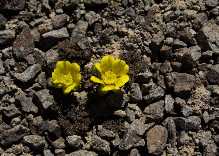
Currently scree plants such as a yellow ranunculus with tiny grey leaves and penwipers are blooming on Mt Barrosa (December).
On claggy days, a map and compass are strongly recommended if you're not carrying a GPS as there are several spurs to lead you off the route. There are no exposed sections to this climb.
It is possible to do this climb as a traverse which then leads you down to the Stour River. I've yet to do this due to poxy weather. To avoid getting wet feet crossing the Stour you can pick up an old 4WD track on the south side of a marked swamp that takes you over a low saddle to reconnect with the track that runs down the Stour. This is quite an attractive bypass route and is not poled.