Information may be incorrect: you are not viewing the latest version of this page. This version ID 11556 created 4 December 20114 December 2011 by madpommadpom.
Three public access routes into Forks Hut and Te Ekaou Hut mean that it is easy to make a visit to these huts into an interesting weekend's round or through trip.
- Marginal strips run up both Te Ekaou Stream and Makawakawa Stream provide challenging but fun access from Pohoingina Road East.
- A ridgeline track down from the end of Tekapari Road combined with good river access upriver from the hut mean that access to and from the main Ruahine Ridgeline is also simple.
- And for those who want to ask, there is the option of obtaining farmers permission to use his 4WD track directly to Te Ekaou Hut.
Combining this trip with a return via the track from Takapari Road to Diggers Hut and Makawakawa Stream out to the Pohongina Road allows a good weekend loop of Te Ekaou, Forks, Travers/A-Frame, and Diggers Huts
These huts receive very little traffic beyond a dedicated band of about 4 local hunters, and a brief rush of interest during the roar. I suspect that the reason is twofold:
The huts are near the bushedge, and just getting there from the main Pohongina Road does not appear to provide a full weekend of tramping
You may have heard stories of access across farmland being refused - until recently DOC stated that access would not be granted - though that has now softened to 'contact DOC for landowner details'.
However, both of these issues can be worked around.
Through trips from Pohongina to Takapari Rd are possible via Te Ekaou and Forks Hut, and these can be combined with a visit to Diggers Hut to make a round trip and a full weekend of tramping.
Three access routes to Forks Hut are available without crossing private land: marginal strips up Te Ekaou Stream, marginal strip up Makawakawa Stream and a cut track down from Takapari Rd.
Te Ekaou Bridge (Pohongina Valley East Road) to Te Ekaou Hut
6km, 2-4 hrs, river / ridgeline route
A 10m wide marginal strip runs up either side of the Te Ekaou Stream, providing good access as far as the Ruahine Park boundary. Grassed riverflats lie on either side of the Te Ekaou Stream as it passes under the Pohongina Road: going upriver is easy. Soon you enter a V shaped valley, but going remains good on grassy river banks. Occasional strips of scrub or slips force crossings of the stream, but at only a couple of meters wide crossing is not an issue. Going remians much the same for 1.5km until a 10m waterfall is reached - easily passable on the true right. Remaining on the true right, grassy banks continue until the forks 500m before the park boundary. A farm track climbs the true right face, but soon leaves the marginal strip and the only legal access without landowner permission is to drop to the creek as it enters a gorge. Grassy farmland retreats to the plateau above and the sides of the gorge become forested with dense scrub forcing travel on the riverbed and often in the water. The creek is small and should pose no problems in all but peak flows. After about 500m of river travel, a small sidecreek enters from the true right out of a narrow slot gorge. This marks the park boundary.
As shown on the map, a farm track follows the west bank of this sidecreek to the hut, but this runs over farmland and as such permission is required. Instead, climb the ridge to the east of the sidecreek - the first ridge within the park boundary, to reach a stand of pines above. It's a steep tough scramble out of the creek, a slip 50m upriver provides access. Once on the ridge, things improve considerably: a roughly cut track follows the ridge first E then NE running parallel to the park boundary about 300m from the bushedge. At first this runs through scrub 2-3m high, but later enters remnants of mature bush. After about 1.5km a junction of ridgelines is reached marked by a patch of windfall: a ridge runs NNW 800m to Te Ekaou Hut, and the main ridge swings east to intersect the Forks Hut track shortly before it descends to Forks Hut.
For those heading to Forks Hut, continue east along the main ridge until the Te Ekaou Hut to Forks Hut track is intersected after about 500m. It's a broad, marked, cut DOC track and you can't miss it.
Heading to Te Ekaou Hut, the shortest route is NNW along the ridgeline directly to the hut. An old cut track runs along this ridge, hitting the 4wd track 100m SW of the hut. However, this ridgeline track has been all-but obliterated by windfall and it is very hard going. Heading west to the cut track and doubling back is probably faster,
Te Ekaou Hut
Te Ekaou is a tidy, spacious 6-bunk hut just inside the bushedge. There's a wood burner and tank water.
Te Ekaou Hut to Forks Hut
Cut marked track, 2km, 45 mins - 1.5 hrs
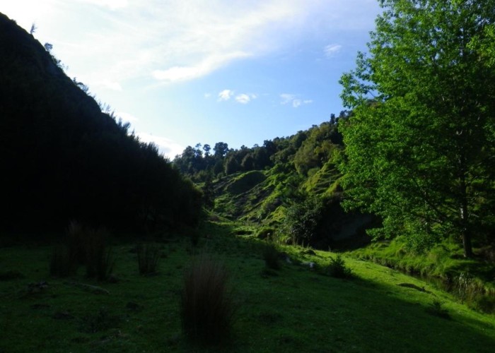
Heading east from Te Ekaou, a well maintained, broad cut and marked track descends to the creek and climbs steadily to the ridge beyond. The area is regenerating bush, with occasional mature trees standing tall above the low canopy - left as seed trees, or unsuitable for logging - I'm not sure. Reaching the lip of the Makawakawa valley the track drops precipitously to the creek. Forks Hut lies on the far bank, upriver of the forks.
Forks Hut
Forks hut is another 6-bunk ex-forestry hut. Again featuring a pioneer stove, and with water from the creek 10m away From behind the long-drop a rough track climbs to the ridge south of the hut, between the two forks. Opposite the hut to the NW, a DOC 'animal control' track marked with pink triangles climbs to the ridgeline. I do not know if this connects with the other pink-triangled 'animal control' track descending the same ridgeline from Takapari Rd, but it seems likely.
Makawakawa Stream bridge (Ponongina Rd East) to Forks Hut.
Riverbed route, 6km, pools and wfalls to navigate
I've only walked the lower section of this route, but hut book entries confirm that it is possible to travel up the river from the Pogongina Rd to the Hut. The Makawakawa is broader and deeper than the Te Ekaou but flows through broader river flats offering gravel and river-rock travel rather than in-the-water options. The valley floor is mainly flat to the park boundary with no falls or pools to negotiate. However, about 5 river crossings are required to reach the forks (where two tributries leading to Diggers and Forks huts) knee to waist deep in normal flows.
Above the forks, the southern tributary leading to Forks Hut is small, but narrow and gorged. Hut book entries mention that several waterfalls and pools have to be negotiated and the route is not recomended after rain.
Forks Hut to Takapari Rd
1. River route, 6km, 2.5-5 hrs
The northern branch of the creek, starting at Forks Hut, provides mostly good going until 500m from its head. Initially river banks are covered in thick scrub and regenerating bush, and travel in on river gravel and rocks. A waterfall is reached after 1km which requires a brief but steep scramble - the true left worked for me. Above the falls, the valley opens a little, and scrub is replaced by grassy banks and open valleysides, with clearings on the valley floor providing good camping spots. Bush is replaced by 2-3m high scrub and slopes are dotted with fern trees - though occasional standing totora remain here too. About 500m before the next forks, a DOC animal control track marked with pink triangles climbs to the ridgeline to the north. It is a fair assumption that this joins that dropping from Takapari Rd, and possibly also joins that climbing from Forks Hut, but this has not been confirmed. Feel free to try them out and update this article one way or the other.
I ignoried the track and headed on up the river which continued to provide good travel. Another waterfall just beyond the track required another scramble - true left again did it for me. Taking the northern branch at the next forks, climbing more steeply I entered thatcopper-coloured scrub that warns that leatherleaf is not far above. Going remains good until a tall 20m waterfall is encountered about 500m from the head of the creek. Take any good-looking route up to the rideline to the north - there are several grassy slips below the falls, and gentler wooded creeks just above. All provide reasonable access to the ridgeline. On reaching the ridge you'll pick up a cut, well-marked ridgeline route heading for the summit and Takapari Road.
The ridgeline route is marked with pink triangles and cut in places through scrub. On reaching the leratherleaf it becomes a 1.5m wide cut track, though as you climb higher the leatherleaf starts to encroach more and more. The last 30m are uncut - presumably to hide the track for some reason. The track reaches the Takapari Road 200m beyond the end of the gravel. For those heading down to Forks Hut from the summit - head 200m past the end of the gravelled road and look for a small area of stumps where a pull-off has been cleared on the east of the now-boggy track. The track west to Forks starts opposite this - a DOC 'this is an animal control track ...' sign after 30m lets you know you're in the right place.
2. Ridgeline Route
I'd bet that the DOC pink triangle track climbing from 1.5km above Forks Hut and the DOC pink triangle track descending from Takapari Rd join up.
I reckon also that the DOC pink triangle track climbing opposite Forks Hut and the other two DOC pink triangle tracks probably also join up.
Someone can go and find out and report back. If so - you'll knock at least half an hour off the above times.
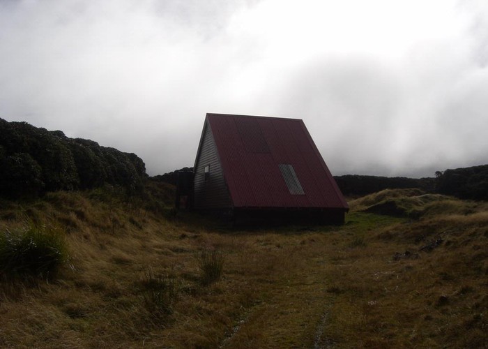
Takapari Roadend to Travers Hut
4wd track, 5km, 1-1.5hrs
It's a 5km, 1hr stroll along the 4WD Takapari Road throgh an unending sea of leatherleaf to the Travers-A-Frme Hut.
Travers sleeps about 4 on one platform but has no matresses and no woodburner. There is, however, tank water.