Longview Howletts Daphne Circuit
Ruahine Forest Park
- 2 – 3 days loop track with a road section
- Medium
A circuit in the Ruahines taking in three well equiped huts
|
Walking time
|
2 – 3 days |
|---|---|
|
Distance
|
18.4km |
|
Type
|
Loop track with a road section
|
|
Grade
|
Medium |
|
Bookings
|
No bookings — open access
No — open access
|
|
Starts
|
Moorcock Saddle |
|---|---|
|
Ends
|
Kashmir Rd |
|
Maps
|
NZTopo50-BL36
|
|
Altitude
|
580m
–
1,520m
Altitude change 940m
|
Moorcock Saddle to Longview Hut 1.5 hours
The track begins from the DOC carpark on Moorcock Saddle. It immediately begins to climb up a prominent ridge towards the hut. It isn’t long before Longview Hut can be seen up ahead. The track climbs slightly above the hut to a junction where a sign indicates the short side track to the hut.
Longview Hut to Howletts Hut 4-5 hours
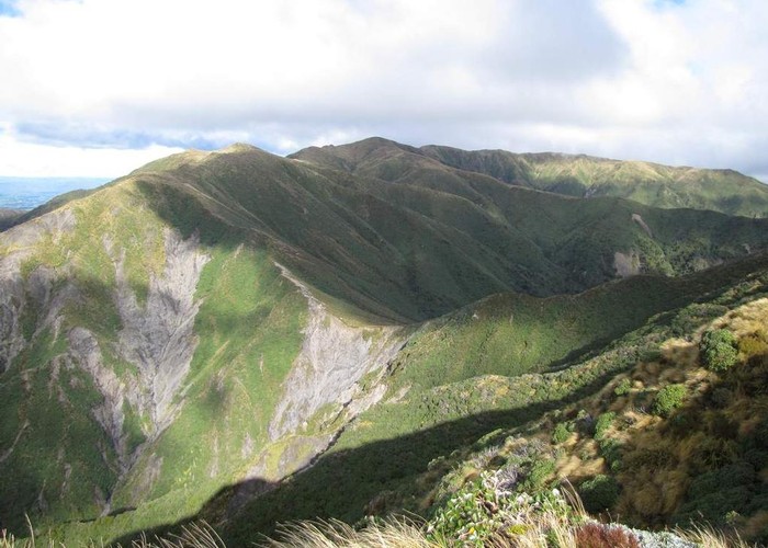
Back track to the junction on the track and then descend slightly to Pohangina Saddle and then climb 300m to the top of the Ruahine Range. Watch out for the NZ Native Falcon on the way up. We saw several.
The top of the ridge you are a short distance from the summit of Otumore, the highest point on the trip. From here the route follows a long ridge to the north. On a clear day you will be able to see the the little hill on Daphne Ridge where Howletts Hut is situated. The route is marked by the occasional old Forest Service era, iron warratah.
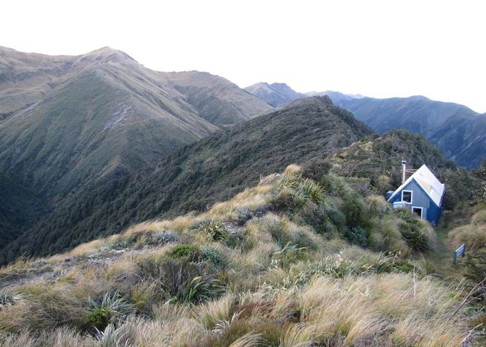
When the ridge begins to drop more rapidly a sign post indicates the direct route to Daphne Hut to the right and a left turn to Howletts. A descent of 150m takes you through a saddle with a large slip on the northern side. It then climbs again to gain Daphne Ridge and the summit of Taumatataua.
From here it mostly a gentle descent through leatherwood patches. Then finally a short climb to Howletts Hut, which sits in a hollow behind a knoll on the ridge.
Howletts Hut to Daphne Hut 1.5 hours
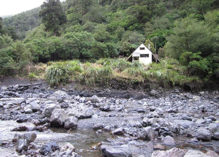
From Howletts the track descends immediately, soon gaining the bush finally dropping even more steeply as it gets to the bottom of the valley. The hut can be seen immediately below you on the opposite side of the river.
If you are going in the opposite direction, the track begins on the true left bank of the side stream that joins the main stream, just below the hut.
Daphne Hut to Kashmir Rd 4-5 hours
From the hut, head downstream, following the river for about 600m. This is in a gorgy section so you will get wet feet and it would be tricky if the river is high.
The turnoff up the ridge is well marked by a large orange triangle. From here, climb 400m through pleasant bush before turning left at a junction just before bush line. The route traverses along a ridge section for a few minutes and then descends sharply, coming out of the bush into scrub. The carpark is seen far below and after a knee jarring descent and a short crossing over regenerating farm land you arrive at the DOC carpark.