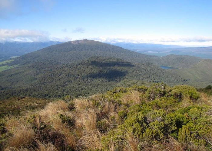
Tihia Track
Tongariro National Park
- 3 hr – 5 hr loop track with a road section
- Easy/medium
A rough loop track and hard to find. But a worthwhile trip to a summit with good views
|
Walking time
|
3 hr – 5 hr |
|---|---|
|
Distance
|
4.6km |
|
Type
|
Loop track with a road section
|
|
Grade
|
Easy/medium
Ends of track hard to find. Overgrown and no markers Grades explained
|
|
Bookings
|
No bookings — open access
No — open access
|
|
Starts
|
State Highway 47 |
|---|---|
|
Ends
|
State Highway 47 |
|
Maps
|
NZTopo50-BH35
|
|
Altitude
|
638m
–
1,182m
Altitude change 544m
|
ID 6973
About this track
241 views in the past year (20 per month).