Comments
-
 Honora Oops! Nearly forgot to say thanks for the thumbs-up. It's good to hear my posts are appreciated. I'd love to see some good routes shown on here too to get me out there.
9 October 2010
 -
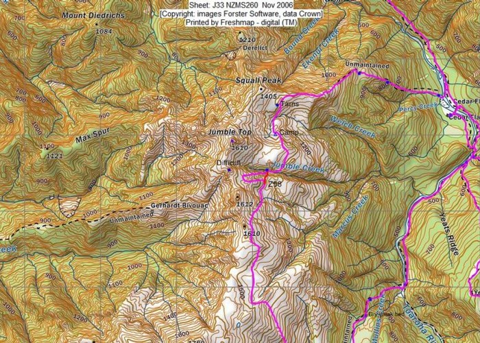
 Honora Doug put that word 'difficult' on the top of that high point. I assume he extrapolated this from the remote huts website. I think it refers to a descent from that point to travel north along the ridge.
Andrew Barker probably knows more about this area. I've only been there once. Glenn J is probably also a frequent visitor. Getting down off the ridge to Mullins Hut is straightforward with no exposed sections and lovely terrain and vegetation. When we did it there was the odd cairn here and there but you could always load Doug's track in your GPS. It follows some good terrain features e.g. spurs and good creek crossings.
9 October 2010
 -
 lewshaw I appreciate your track posts,both from a practical as well as a motivational way.
Maggie & I are heading in to Gerhardt Biv over Labour weekend.Your map shows a `difficult` section where this spur joins Deidrich Range.We intend to go out via Mullins Hut & out the Toaroha.One of us isn`t match fit.How difficult is this section?
Years ago(I`ve seen a few moons)local aeronoughts talked of a plateau near the Hokitika Gorge,that was a tempting landing site,but thought impossible.One character,Nash Taurau,did land on it,but smashed the nosewheel in the process.The plane was choppered off.I`m wondering if the Gerhardt Bivvy area was this site? Cheers,Lew
9 October 2010
ID 6013
About this photograph
License
All rights reserved
88 views in the past year (7 per month).
