Upper Whirinaki Loop
- 6 hr 30 min – 8 hr loop track
- Easy/medium
An Easy two day loop in the Whirinaki Forest park
2 members favourited
3 members checked in
|
Walking time
|
2 days
6 hr 30 min – 8 hr
|
|---|---|
|
Distance
|
20.0km |
|
Type
|
Loop track
|
|
Grade
|
Easy/medium
Some creek and river travel watch weather forcasts Grades explained
|
|
Bookings
|
No bookings — open access
No — open access
|
|
Starts
|
Plateau Rd Carpark southern end Whirinaki track |
|---|---|
|
Ends
|
Plateau rd carpark |
|
Maps
|
NZTopo50-BG38
|
|
Altitude
|
300m
–
984m
Altitude change 684m
|
Plateau Rd Carpark to caves a graded walking track easy going about 1.5 hours. About 100 metres upstream is a rather large cave worth visiting. Watch out for blue duck always seem to be a couple in residence.
Caves to taumutu stream about 1/2 an hour a continuation of the well graded walking track. At the junction with Taumutu stream you turn upstream at the wooden brige and the track becomes a tramping track following the stream for about 1/2 an hour. Lots of wind fall and recent flood damage.
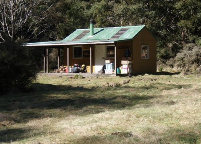
Exit the stream at a junction with a track to Mangamate hut and head roughly 1.5 hours south following the taumutu stream to Upper Whirinaki hut set at the back of a reasonable clearing. a relatively easy 3 to 4 hour day.
The next day exit the clearing at the northern end taking the Tehoe track for about 15 minutes to a crossing with the upper whirinaki river. The track back to plateau rd starts here climbing quickly to the ridge top and then down to plateau rd. 2.5 to 3 hours.
Some great Whirinaki bush with abundant wild life an easy walk to strech your legs and a tidy 9 bunk hut for the night.
We reached plateau rd from the south, off the Napier taupo rd via Waipunga valley rd and pine milling rd but i would keep a map and gps handy as the road signs are few with many forestry roads heading off all over the place.