
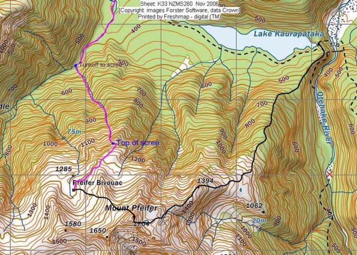
Access
The track along the Taramakau River starts at a car park at Aickens Corner, where the SH73 bends westward from the Otira River to follow the course of the Taramakau. There is an intentions book here. The Otira River is commonly over waist deep, and will block access to the Taramakau Valley in wet weather. A swingbridge is located south along the Otira, although the flood track along the east bank is reported to be difficult and overgrown. In short: don't set out on this trip if the forecast is bad.
Aickens Corner - Lake Kaurapataka: 2-2½ hr, easy + river crossing
Follow the fenceline down to the Otira River and cross to the wide flats opposite. Pick your way through the gorse to a vehicle track and marker opposite. A shelter is nearby. From here the track meanders across cattle flats, often losing its way, but generally keeping to the top of the flats. The Otira flood-route turn-off is near the shelter.
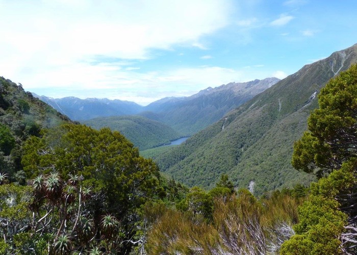
The Taramakau valley is indescribably dull, but at least you leave it behind soon enough. Pfeifer Creek is the first small valley entering the Taramakau, generally a dry shingle bed. Up the creek a couple of minutes, a smooth, cool track starts in the ferny beech forest on the true right bank. About 40 minutes on, the track bends alongside and crosses Lake Creek, the lake outlet. Lake Creek arcs around the base of a massive slip from the northern flanks of Mt Pfeifer that blocked the valley and formed Lake Kaurapataka.
Eventually, you sidle around the lake, which remains hidden in the trees. You become aware of its presence before you can see it, glimpsing first the distant hillside over the lake, then spots of water through the foliage. Finally, a distinct side-trail drops to a delightful grassy area midway along the lake. Currently, it is marked by a large arrow of stones in the middle of the track! There's lots of room for camping at the lakeside.
Lake Kaurapataka - Otehake Hot Springs: 1 hr, easy-medium + Unmarked route + river crossing
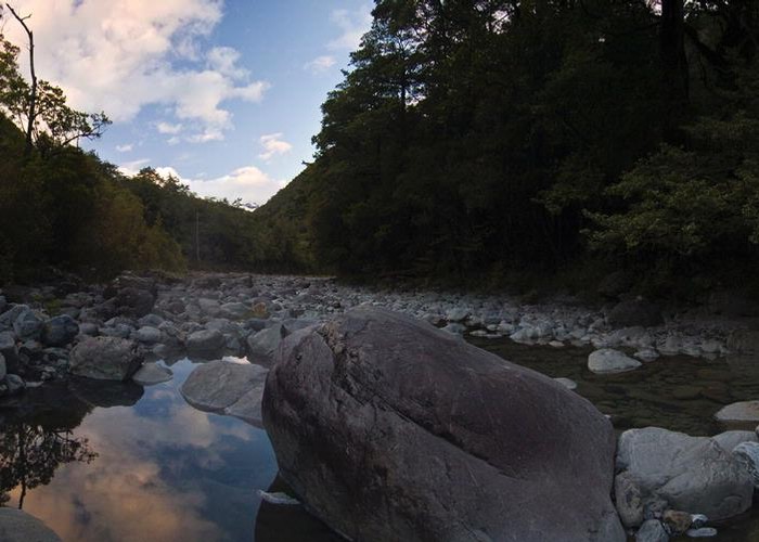
The track from here becomes noticeably rougher and more rootbound as the shoreline gets steeper. Beyond the end of the lake, the track climbs to a very low saddle, where a steep descent drops directly to the Otehake River, coming out under a swingbridge. An alternative route from the saddle heads off to the right and cuts out some river crossings. A brief gorge here offers a few deep swimming holes between the rocky banks, and about four deep fords.
Out of the gorge, a prominent (but unnamed) spine of rock rises to the right and above the river in the distance. Follow the hints of sulphur in the breeze to their source at a decent set of hot springs.
These springs are some of the best around, second only to the Welcome Flat springs on the Coast. They are set in a dry channel to the true right of a small, distinctive island, with good camping under the trees on the island, and in the bush on the river bank. The site is well used, but in good condition.
The bush around here is rich with variety. On the island alone, you can count off the trees overhead: red beech, rata, lancewood, kamahi, broadleaf, tarata. Rocks around the campsites are bearded with stems of Earina autumnalis, the Easter orchid, and in Autumn decorated with their scented spikes of tiny flowers. On the riverbank, the tall beeches shelter a green forest floor of thick mosses, and a variety of ferns.