Mangamuka Hut loop
- 2 days loop track
- Easy
A two day pleasant walk over old tramlines in the Lower Kaimai Mamaku forest park with a night in a small well kept hut.
|
Walking time
|
2 days
10 hr – 12 hr
|
|---|---|
|
Type
|
Loop track
|
|
Grade
|
Easy
No major challenges except time though the area is heavily used by hunters Grades explained
|
|
Bookings
|
No bookings — open access
No — open access
|
|
Starts
|
Whakamarama rd |
|---|---|
|
Ends
|
Whakamarama rd |
|
Maps
|
NZTopo50-BD36
|
|
Altitude
|
480m
–
580m
Altitude change 100m
|
Leaving your transport at the carpark at the end of Whakamarama rd opposite the farmers fancy gate walk about 12 minutes down the remaining road to the start of the track. 4x4's and utes are ok here but if you value your cars under body walk for 12 minutes.
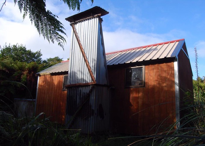
2 minutes into the track and you meet your first sign posted junction. Turning right sidle around on recently worked on track before a short climb up on to the ridge top and Te Tuhi track. From here the track heads west over the Kaimais following an old tramline through cuttings and regenerative bush to your next track junction with the North South track (this portion of the track is well marked and recently cleared) about 2 and a half hours travel. Turning left and south head down the North South track (an old DOC sign advises this track is for experienced trampers only and is non Maintained but this has since changed the track is well marked and heavily cleared). About 1 and a half hous will see you arriving at a small clearing which hosts Ngamuwahine bivvy (not marked on the new topo 50 maps). at best a tinroof to getout of the rain its a bit of a rat hole. 30 minutes south cross the Ngamuwahine stream and on the south bank the next sign posted junction to Mangamuka hut track (this track is also missing from the new topo 50 maps). The track is well marked if a little overgrown. Turning up the track and a small climb before heading gently down the ridge to Mangamuka hut about 1 hour 15 minutes. The hut is a tidy 4 bunk hut with water nearby and an open fire. well used by local hunters there is a clearing above the hut for camping if the hut is full.
The next day retrace your steps back 1 hour and 15 minutes to the north south track. Turning south about 2 hours will see you to the next track junction wher the north south track continues on to Hurunui hut and places south. Turning left here start a gradual descent to Leyland Obrien track. The leyland obrien meanders beside the Ngamuwahine river back to Wakamarama rd about 2 hours travel.
All these tracks are well marked and with the exception of the Mangamuka hut track very broadly cleared. as you are walking on mostly old tram lines the gradient is very kind with few very small climbs. I wouldnt walk this track during the roar as it is a popular area with deer stalkers and weekend wariors alike. The deer stalkers are great but the weekend wariorsare a worry.