Little Mount Peel
- 5 hr loop track
- Easy/medium
A popular walk at the edge of the Canterbury Plains
|
Walking time
|
1 day
5 hr
|
|---|---|
|
Distance
|
8.5km |
|
Type
|
Loop track
|
|
Grade
|
Easy/medium |
|
Bookings
|
No bookings — open access
No — open access
|
|
Starts
|
Blandswood Road end, Peel Forest |
|---|---|
|
Maps
|
NZTopo50-BY19
|
|
Altitude
|
350m
–
1,311m
Altitude change 961m
|
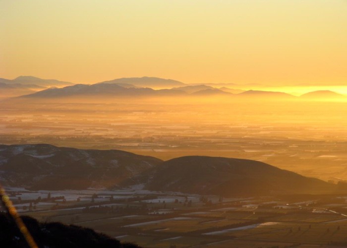
This walk offers sub-alpine tops, panoramic views of the Canterbury Plains, and a cute little shelter perched at the summit. It is a very popular family walk. The easiest route is via Deer Spur, and most visitors walk there and back along Deer Spur. But a second, steeper route leads up the South Ridge, offering an interesting and more challenging loop.

From Peel Forest, take Blandswood Road and turn just before the ford. A car park is nearby. Walk uphill to the road end, where a track starts, heading off into forest.
Deer Spur: 2.5 hours up
This track is part of the Fern Walk, and the forest floor is carpetted with hound's tongue. Soon, a variety of other ferns appear, then the Deer Spur Track sets off to the left. This track climbs continuously, passing the Allan's Track access junction 30 minutes from the car park, and a small boggy pond soon after. This was once described as a nice lunch spot, but it doesn't really look like one. From here, the track cuts into dracophyllum, broadleaf, manuka, and pseudopanax then flattens off onto Deer Spur. A steepening climb leads up the tussock slopes then follows the ridge left to the Tristram Harper Memorial Hut.
The little hut is situated just beneath the trig, and offers good views. There is a water supply and toilet. Inside are two bench seats. Most visitors use the hut as a day shelter but there doesn't seem to be a rule against staying the night. (Camping would also be possible about 30 minutes along the ridge to Mount Peel.)
South Ridge: 2.5 hours down
Starting behind the hut, the poled route drops quickly along the ridge through dracophyllum scrub. At about 1 hour 10 minutes, watch for a pole marking the route left off the ridge (the spur is just southeast of point 775). The track drops into forest and crosses Emily Stream just above the falls. A nearby track doubles back for a view of the falls (1 hour 45 min from the hut). From here, an easy track crosses Rata Stream again and sidles above it, meandering back to Blandswood.