Mt Stokes
- 4 hr 30 min – 6 hr return via same track
- Easy/medium
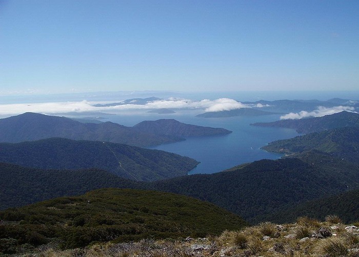
Ridge walk to the highest peak in the Marlborough Sounds. In native forest except for the last 20m up and 170m to the summit. Yellowhead conservation area.
|
Walking time
|
4 hr 30 min – 6 hr |
|---|---|
|
Distance
|
6.0km |
|
Type
|
Return via same track
|
|
Grade
|
Easy/medium |
|
Bookings
|
No bookings — open access
No — open access
|
|
Starts
|
Anakoha / Titirangi Roads intersection |
|---|---|
|
Maps
|
NZTopo50-BP29
|
|
Altitude
|
580m
–
1,203m
Altitude change 623m
|
|
Link
|
www.doc.govt.nz/parks-and-recreation/tracks-and-walks/nelson-marlborough/sounds-area/mount-stokes-track/http://www.doc.govt.nz/parks-and-recreation/tracks-and-walks/nelson-marlborough/sounds-area/mount-stokes-track/ |
|---|
You're straight into coastal podocarp with the track sidling the hill for about a km, a bit rooty and boggy, then you hit the saddle where there is beech mixing in. Suddenly the mostly level track is over and the ridge climb starts in earnest, doing the last 450m up over the last km. As usual, the beech starts to get gnarly near the top, with more wood on the ground than on the trees. When you break out of the treeline, the sub-alpine summit is an almost level walk north to some rewarding views of the North Island, Picton, the Sounds (of course) and Nelson and Bays. (http://www.doc.govt.nz/upload/documents/parks-and-recreation/tracks-and-walks/nelson-marlborough/mt-stokes-tramping-track.pdf)