Six Foot Track - Framptons Hut - Hauturu Highpoint Track
Waima Forest
- 4 hr – 6 hr one way
- Easy
Northland is better known for its beaches than its tramping. But if you get bored withthe salt and the sand this is an interesting trip in the Waima Forest
|
Walking time
|
1 day
4 hr – 6 hr
|
|---|---|
|
Distance
|
10.0km |
|
Type
|
One way
|
|
Grade
|
Easy
The Hauturu track is a little rougher under foot Grades explained
|
|
Bookings
|
No bookings — open access
No — open access
|
|
Starts
|
Mountain Rd |
|---|---|
|
Ends
|
Waiotemarama Gorge Rd |
|
Maps
|
NZTopo50-AW27
|
|
Altitude
|
140m
–
679m
Altitude change 539m
|
This track starts at the end of Mountain Rd, which turns off State Highway 12 east of Opononi. Part way up the road a sign indicates that the road is not maintained beyond this point. The road is actually in good condition and there is turning at the beginning of the track. Continue until you pass a group of houses and you will soon come to a sign indicating the “Six Foot Track”. The track is actually an old bridle trail so, while erosion has reduced its width somewhat, it is a very easy gradient.
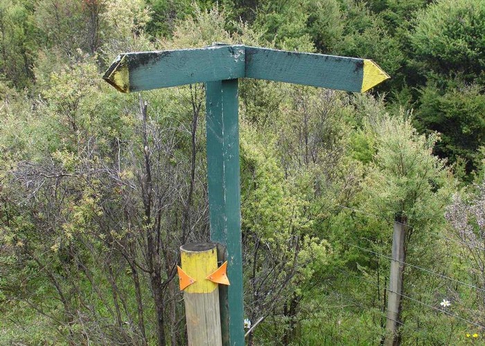
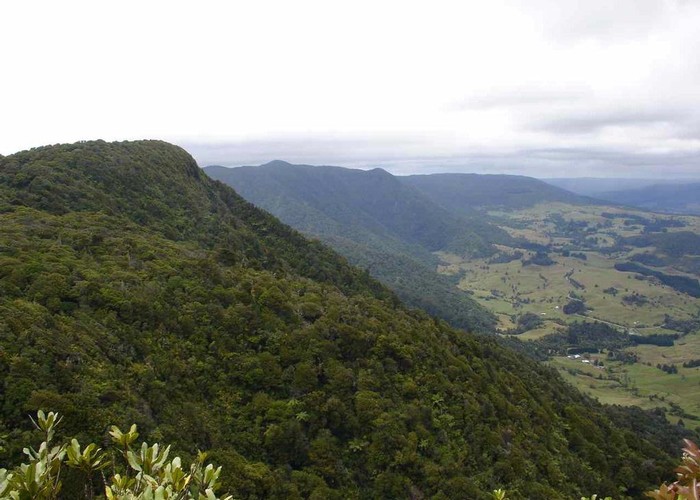
After about 45 minutes of traversing with glimpses of the Hokianga beyond the track turns into a tighter valley with a fence to the left and some boggy patches before coming out at a stile, crossing the fence and onto a four wheel drive track. There is a finger sign here but there is nothing written on it to indicate the way. Continue to the left, following the fence before you come to another stile and this time the finger sign points up the hill to Framptons Hut and another indicates the way to Hauturu.
The hut is about ten minutes up the track and well worth a visit. It is also worth carrying on the track for about 30 mins to get some views over the Hokianga as the view from Hauturu itself is limited to the south.
This area is obviously and old farm and is now reverting to scenic reserve status. There is still pasture grass around, the hut is the old farm house and apparently there are still some wild cattle around.
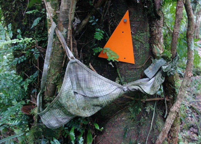
After visiting the hut, go back to the last finger sign and follow the track to Hauturu. This track is level for a while, passing over more boggy bits before a large triangle appears to the right with Hauturu written on it. Veer up here. There is another marked track sidling away here, don’t follow that.
The track now climbs steadily eventually it becomes apparent that you are following a narrow ridge and then dips through a small saddle before the final ascent to Hauturu. The trig is along a sidetrack with a view point 20-30m past the trig.
From the junction the track drops a little and then carries along fairly level for while. There are views to the left, looking back at Hauturu and south towards the Waipoua Forest.
The track drops in steps and after about an hour you come to a magnificent Kauri grove. It is a privilege to be walking amongst these trees, young and old. Soon after that the track emerges onto a loop track with a sign saying “Hauturu 2 hours” pointing the other way. Take either leg of the loop, it doesn’t matter. The track is now good and you descend into the stream and the Waiotemarama Falls.
It is a final 10 mins walk on a benched track to the carpark on Waiotemarama Gorge Rd.
If you are dry and in need of refreshment here, just cross the road bridge to the Puzzle Shop. They sell canned drinks for $1 and a lot of interesting puzzles as well.