
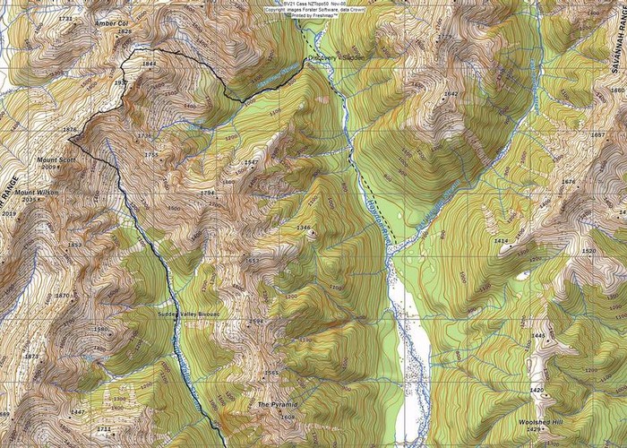
This is a circuit that can cause grief if the wrong tributary of the Discovery is selected. For guidance I consulted Sven Brabyn and Elise Bryant's 1997 revised edition of "Tramping in the South Island, Arthurs Pass to Mt Cook". It recommended a narrow scree-filled gully" which it said could be seen directly ahead after passing a side-stream from the NW. It added that the gully leads all the way to a notch in the ridge. Once at this notch an easy scree-run drops down into Sudden Valley just upstream of the biv.
Well, whoever contributed that route to the authors failed to mention that there are near vertical argillite bands near the top of the ridge. I presume at the time of crossing this gully is usually filled with snow. We had a snow lead but where this ran out we had a choice of ascending vertical crumbling argillite sans hand holds or an even crumblier narrow gully. The run out was a narrow but deep abyss under old avalanche snow. Not having a death-wish we backed off and returned whence we came. The route can be done easily in late Spring/early summer of course but having almost ascended to the ridge and with the descending route visible from the Sudden Valley, any sense of exploration is now gone.
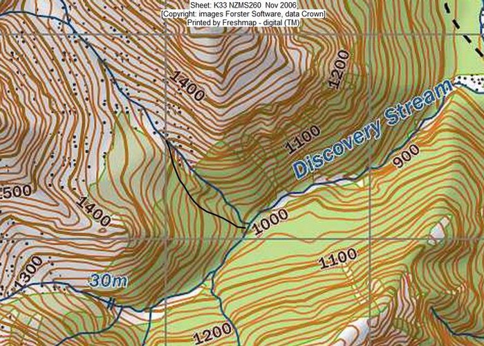
Pat Barrett mentioned in his Canterbury Foothills and Forests guidebook a different longer route involving a short traverse of the Polar Range. I may combine an ascent of Amber Col from the East Otehake with this descent route into yet another tributary of Discovery Creek that I haven't actually explored. Pat Barrett tells us, "At the bush edge you pass a 30m waterfall on the river right". River right? He doesn't provide a glossary of terms. Does he mean "true right"?