
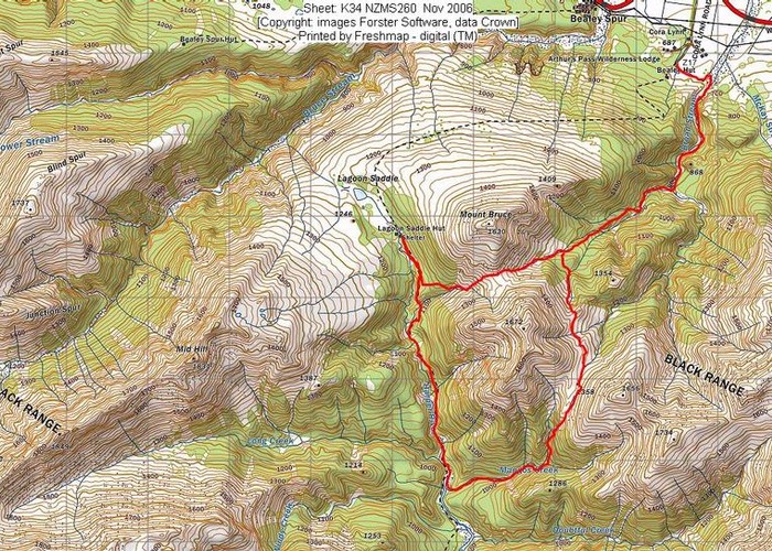
Broad Stream to Lagoon Saddle and Return via Mangos Creek
I’ve met various members of the Mangos family over the years and told them about Mangos Creek in the Craigieburn Forest Park. I’ve told them that I planned to explore the creek one day. It got added to my list of tramps I want to do and finally the ideal conditions arrived.
As a bushcraft instructor, I’ve often assisted on above the bushline courses held on the
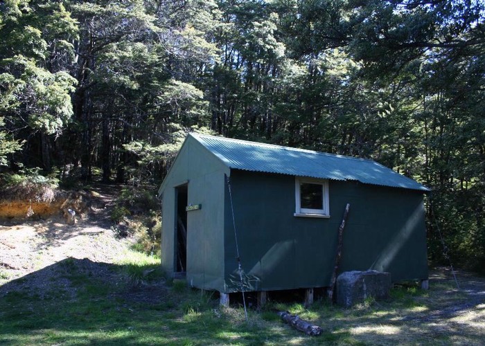
I also wanted to stay at the West Harper hut, which is old and a bit rundown with an open fireplace. Lastly, of course I wanted to travel back via one of the 3 tributaries of Mangos Creek. There was talk of returning via the highest saddle (1565m) but this would lead me to a section of Broad Creek I have travelled on 3 times already so we opted to return via a more interesting route. This was over a lower saddle at 1358m followed by a sidle at the same altitude to cross a saddle on a spur and then a short descent from the head of another tributary of Broad Stream to a triangular plateau on the forested spur where the track we’d come up the day before runs into.
First of all, we had to park the car somewhere safe. We used the trail head by Cora Lynn station where the Cass/Lagoon circuit starts. Then we had to get to Broad Stream. We weren’t keen to do a 2.7km section of going back to the main road, then down it to Broad Stream then up that when instead we could walk across a 500m wide paddock so we took the shorter cross country option directly to where Broad Stream narrows. We dropped down to the stream from the paddock using a track created for the guests of the Wilderness Lodge.
We travelled up Broad Stream to the confluence of the 2 tributaries. In the year since I’d been there the Wilderness people had marked and formed the track further with stone borders,
We were soon at my red line i.e. previously untraveled terrain. We hopped across the creek and travelled up a very pleasant tributary, including a cheval slither uphill on a greasy log for Frank who wished to keep his feet dry. My sandal tread was sufficient for me to walk the log but his trekking shoes are bad news. Eventually the track began to travel up the spur but we didn’t notice it leading off from the river bed until we realized we’d run out of orange triangles.
It was very well marked with just an occasional small obstruction of fallen branches to maneuver around. At an open sunny grassy clearing we stopped to bask in the sunshine while we drank from the stream there and enjoyed a snack. Immediately on resuming our uphill travel, we realized we’d once again mislaid the track. Scouting a couple of meters away from where we’d sat; I found a toppled marker and re-implanted it in the soft bog. I think people are grabbing it as a support as they emerge into the clearing.
We continued, very occasionally having to scout around for markers. At one point the track which went to the edge of the terrace, had been blocked off with branches as a sign not to continue but there was no alternative marked so I found a fallen triangle and attempted to position it in a guiding position in the preferred direction. Overall, it was a very good and enjoyable track. We passed through an enticing open section close to the edge of the terrace with soft vegetation, ideal for camping. Someone else had thought so as there was a fire ring.
Now it was time to leave the terrace and drop down to the open creek bed. This was marked up to a point then we needed to decide which of the two routes now available would lead us to the saddle. We chose the one on the true right and on gaining that saddle realized the other one would have taken us to the slightly lower saddle but it was only a matter of a hundred meters of horizontal distance. Around here we noted the occasional small tarn as a source of water for those who wish to camp here. We paused and it was now around
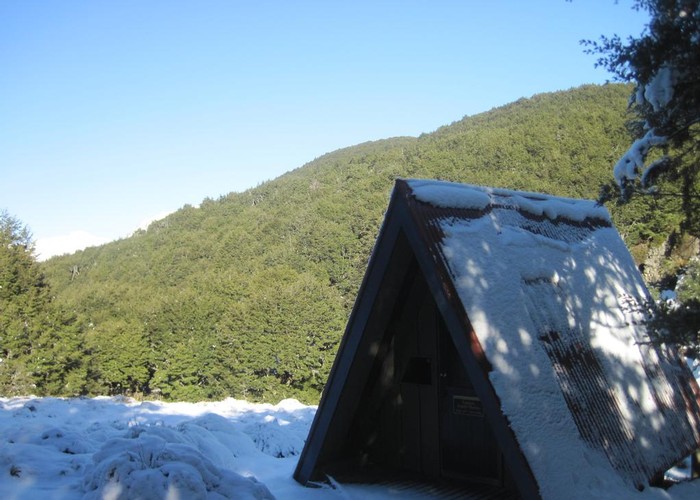
I changed into my long johns and we snacked once again, taking in the novel direction of views to familiar landmarks. We decided it would be more comfortable and less travel to stay at the Lagoon Saddle A-frame shelter. Descent into the head of the stream draining into the
We hit the track, climbed up towards the saddle and arrived at the shelter at
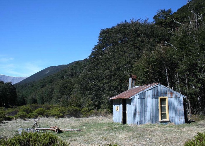
The next day we were up after 8am and away before 10am as there is always a bit of cleaning and tidying to be done when you stay at a hut so near to a road end with the resultant “front country trampers”. We took out a bit of trash but left the wine bottles for the DoC people who fly in to inspect the hut or some decent person who is going downhill. I eliminated a fire ring as there was another nearby and stored the gathered firewood under the hut to keep dry. We travelled down the creek past a junction that is poorly marked which occasionally results in trampers continuing up Long Creek instead of to Lagoon Saddle. There was a Czech couple going up the river. They asked if we’d managed to keep our feet dry: we had and so had they. They had stayed at the West Harper hut the previous night and said it had 2 mattresses.
After nearly 1½ hours from when we’d left the shelter, we arrived at Mangos Creek and stopped out of the wind for a snack. We were on the red line again. Travel was pleasant and varied. We halted for lunch at a 90 degree bend under eroded bluffs just past where the first tributary leads off at
On this trip we’d lugged our ice axes and plastic climbing boots in case of hard snow. The only patch we encountered was soft and satisfactory for our lighter footwear. A 10m traverse across this led to the gentle sustained gradient of a tussocked saddle until we were back in the Broad Stream catchment. There were faint animal trails. We sidled across staying at altitude towards our second saddle. Frank who is faster than I in this type of terrain soon left me behind. I dropped into a stream en route, expecting him to be there enjoying a drink but he was out of sight. I climbed out via a steep dry, mossy face which gave good footing and continued to the second saddle, switching on my UHF radio in case he wanted to make contact.
He wasn’t at the second saddle but I saw him below, sidling above the Broad Stream tributary so I dropped down and began sidling too utilizing celmisia leads through the tussock and scree for descent to easier travelling which avoided a scrub band. Eventually he stopped but so did I to chop out a pine seedling which took a bit of time to do with my ice axe so he carried on. He was waiting for me at the forest edge. Here I took my turn in front which led us to a flat clearing with classic deer wallows. I followed a strong deer trail along a handrail of a slight rise which eventually met the track in the attractive clearing where we’d noted the fire ring the day before.
We descended the track, stopped again at the sunny open grassy clearing for water and snacks and reached the car park by almost