
[Note: this trip report was written by Beth, a friend of mine. The track was walking in October 2008 just after opening. The track has been developed and improved since then and continues to receive further work.]
Bev, Beth and John W left the Fernburn Carpark at the Wanaka end of the Motatapu Valley in the soft embrace of calm warm morning. Jim had kindly relayed us from our vehicle at Arrowtown to save having to tramp back through again afterwards. The morning wound along a valley on well formed, benched track through high country station farmland nipping though red beech of the Stack Conservation Area before reaching the 1/2 built Fern Burn hut after 2hrs 40mins. It appeared that this section of the track would lend itself to running if one was so inclined.
We chatted with a couple of fellow trampers at the hut who had taken twice as long to reach this point, and jovially laughed about how wrong the forecast had turned out to be. Within a couple of hours we were to be found gritting our teeth and battoning down the hatches as the wind rose, temperature fell and large snow flakes turned the yellow landscape white. The track benching had stopped at the hut and it became even more apparent the considerable spacing between waratahs. During the trip up in the car we had endeavoured to correlate the oblique route from the track guide with the topo map with little success. It wasn't helped by north being on the bottom of the track guide and features that inverted mountains and valleys when the map was tipped upside-down....quite the optical illusion.
In addition to this the landscape is carved by many large scoured guts that didn't feature on the topo map. Travel would be interesting in this terrain if one ended up navigating just by the map, a possibility that was looking more likely as we cast out from one waratah to the next.
We reached the second hut after 3.5 more hours and stomped the snow off ourselves. And what a lovely new hut it was. Our thoughts of lighting the fire for our companions soon went out the door when we realised there wasn't one - obviously these Otago folks are made of sturdier stuff than us Fiordlanders. The hut's the same style as the Green Lake hut in a lovely open setting ringed by mountains. Beth's lentil curry offerings were nice at the time but regretted later as the inevitable flactulance set in. There was also a very poor show in the after-dinner aperatif department as we lamented how nice a little dram of whiskey would have been (note to self...ensure there are good drinkers on next tramp). Team 2 (or the opposition as Bev had started referring to them) arrived a couple of hours later mysteriously still dry, our tramping clothes by contrast dripping morosely from hooks by the door.
The snow got us thinking about Plan B in the event that navigation was unsafe the following day. Robyn of Team 2 describing having stayed in this Highland Creek hut as an official during the Motatapu Bike Race. They had got there by all terrain vehicles. Studying the landscape and the map had our eyebrows climbing into our hairline with incredulity especially when she insisted they had just "driven up the river". The map showed a few merging contour lines that would suggest that these vehicles would truly have had to be all terrain. After a couple of hours, and having found the toilet was mysteriously facing the opposite direction in relation to the hut to her recollection she confessed to perhaps having had a blond moment and that maybe it had, afterall, been Roses Hut they had stayed at.
The weather broke during the evening and a nocturnal toilet trip revealed a beautiful star filled sky. We strapped Bev's little pastic in-step crampons onto boots, freed our iceaxes from our packs and set off with interest in the morning. The hut book told a tale of traverses between Roses and Highland Creek huts taking 50% longer than the track guide and in a tone of "OMG" and "never again". The day was one of many sidles contouring around steep faces, made considerably easier by all of the sheep tracking, a further reminder that we weren't on conservation land. Interspersed between the sidles were steep ups and downs working our way over the ridges of Mt Knuckle. We took 7hrs. The present route guide predicted 5-6hrs, the redraft 6-7hrs and the hut book entries 8-9hrs. Presumably the people who found it easier than this didn't feel compelled to record their times. It was certainly a decent days walk. Views were fabulous and we revelled in this exciting mountain route, grateful that it had not followed the valley.
There was Roses Hut, a gentle couple of minutes drive from the Motatapu Valley on 4WD track. The toilet was indeed facing away from the hut but it was hard to see how one could ever have confused the location of these huts. Still, took our minds off sore legs, and the jetlag and lung fatigue John was suffering from. (Served him right for having a month in Madagascar while the rest of us worked through a Fiordland winter!).
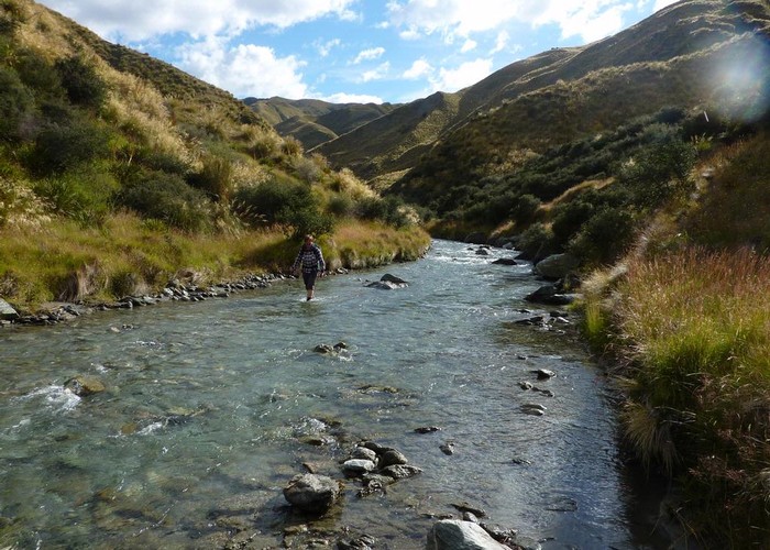
The final day was up and over Roses Saddle behind the hut into the Arrow River where we elected to river bash rather than another long convoluted sidle. The goats were visibly evident along exposed faces; their odour pervading the length of the river. It took us 4hrs to Macetown then a further 3.5hrs to Arrowtown over the Big Hill route. The novelty of running into people (including Beth's old maths teacher) slowed our progress as we stopped for chats and allowed the legs a bit of recovery. Some scoffed at our ice axes on this summery afternoon...presumably people who would be adding to the liteny of hut book entries at Highland Creek some time in the future.
Nomad Safari's had quoted $700 to cart us from Macetown to (no, not Brisbane as you may have thought reasonable but) Arrowtown. They are obviously doing a bit of early buffering against the predicted depression. It did take some willpower and an absence offers of rides for us to drag ourselves out of the valley and up over another big hill but Bev had been assured that this was the fastest route.
So all in all a fabulous tramp, almost totally devoid of other trampers despite it being a long weekend. The forecast could have put the sensible ones off and others had "better" offers, eh Cathy...bet you regret that decision now that you can see how toned our leg muscles are!!! We've decided to rename it the Motatapu Mountain Route to avoid confusion with the comparative highway down the Motatapu Valley. I'm inclined to think it has a level of difficulty akin to the Dusky although there the comparison stops. As Bev says, a true trampers track.