Kaikoura Peninsula Walkway
- 1 hr 30 min – 4 hr one way
- Easy
A seashore and clifftop walk exploring the wildlife and the limestone landscape of Kaikoura Peninsula.
|
Walking time
|
1 hr 30 min – 4 hr |
|---|---|
|
Distance
|
8.3km |
|
Type
|
One way
|
|
Grade
|
Easy |
|
Bookings
|
No bookings — open access
No — open access
|
|
Starts
|
Point Kean, Fyffe Quay, Kaikoura or South Bay Parade, South Bay, Kaikoura |
|---|---|
|
Maps
|
NZTopo50-BT27
|
|
Altitude
|
Sea level
–
60m
Altitude change 60m
|
This track forms a figure-eight loop along the cliff tops and shoreline at the end of the peninsula, so you can walk one long loop or either of two shorter loops. The shoreline section is only accessible between half and low tide — check at the Information Centre for tide times.
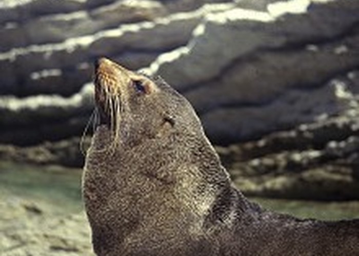
The track provides access to an important breeding area for New Zealand fur seals, and is consequently becoming very popular. Please don’t disturb them as they must cope with a constant stream of visitors, and they are potentially dangerous.
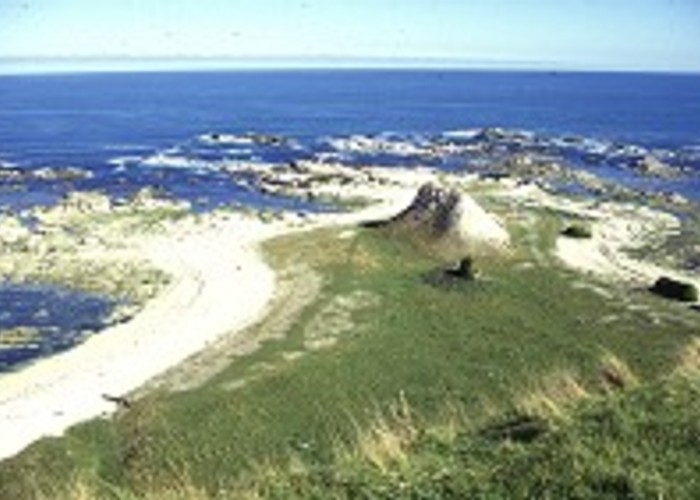
The northern end of the track begins at the Point Kean car park at the eastern tip of the peninsula. Road access from Kaikoura is by following the coastline along the Esplanade. The road becomes Avoca Street and then Fyffe Quay as it passes the historic Fyffe House and an abandoned whaling station. Single male seals use the flat land around the car park area as a winter haulout. At low tide, a large and fascinating tidal flat appears beyond the car park.
By road, South Bay is accessed by driving south out of Kaikoura and turning left onto South Bay Parade at the foot of the hill where the road meets the coastline. Follow the Parade to a picnic area and car park. On foot, a 45 minute track crosses the peninsula from Torquay Street in Kaikoura to South Bay Parade, providing a quicker and safer alternative than the highway.
From Point Kean, the cliff top walk climbs above the car park and crosses farmland on top of the peninsula, with views down to the jagged coastline, and inland to the Kaikouras. At Whalers Bay, a track descends the cliff to allow you to return to Point Kean along the shoreline. Walking time for this loop is about 1.5 hours, but allow time to explore the rock pools, platforms, cliffs, and wildlife.
From Whalers Bay, the cliff top track cuts inland to South Bay (30 minutes), returning along a dramatic section of coastline, past the rock stacks and sea caves of Atia Point (1.5 hours). The loop from Point Kean takes 1.5 hours walking, while the loop from South Bay takes 2 hours. Allow 3.5 hours walking time for the entire track from Point Kean to South Bay and return.