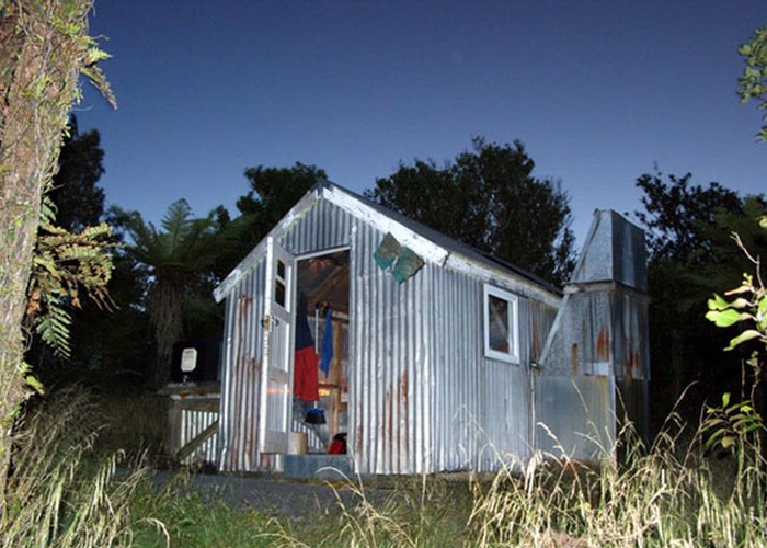
Motutapere Hut is one of five nearly identical huts built in the 1970s by the NZFS. DOC were planning to remove some structures, but the Deerstalkers Assn has come to rescue, and, in 2006, upgraded some of the huts.
Drive:
35km north of Tauranga, turn left into Thompson's Track (road) and drive 5km to the carpark. After this, it becomes a boggy mess which only motorbikes can negotiate. Very occasionally, a 4WD vehicle might make it right over the range from the Waikato side.
Walk:
Or slip, slop & slide if it's been raining recently. Allow 2-3 hours on this 4WD track. The 300m ascent is gradual, and the easiest way to gain the main ridge. (2:00)
About one quarter of the way up, look out for a random old sign on the left, and some yellow tape around a tree on your right. This is the turnoff to the Mt Eliza track. (There's no signpost indicating this, but there clearly should be.)
At the top, there's a concrete surveying block, and a mess of dirt bike tracks. (Again, there's no signpost here.) Follow the path immediately to the right of where Thompson's Track disappears down toward the Hauraki Plains. Head uphill into the bush - this track has just been cleared - for a few minutes before finding the farmland.
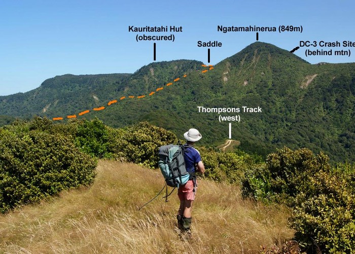
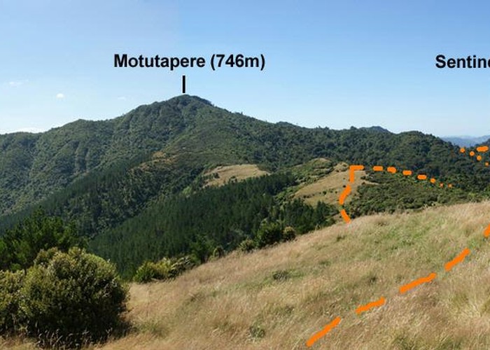
Here, there are fantastic views back toward Ngatamahinerua (849m), east to the Tauranga harbour, and nor-east to Mt Eliza and Sentinel Rock. View to Motutapere and Sentinel Rock
Traverse four grassy hillocks, following the marker poles in a northerly direction, towards the bulk of Motutapere (746m) which looms ahead. But don't climb the fifth grassy knoll (like I did). Look out for a solitary marker pole, with red stripes, on your right. (There's no signpost here either.) (2:40) Head into the bush, follow the orange marker triangles on an easy, well-marked track for some 20 minutes to a new DOC signpost. Here is the turnoff over Mt Eliza. (3:00)
From here, the route is a little overgrown, and uneven underfoot, sidling well below Motutapere, climbing in and out of small watercourses for half an hour. A log staircase is helpful, then an old slip is passed. When you drop steeply down a valley face to the top of a five-metre waterfall, you're only 15 minutes from the hut. (3:30).
Finally, a new DOC signpost tells you the hut is two minutes down a short trail. (3:45)
Motutapere Hut Motutapere Hut is in relatively good condition, sporting a decent water tank, three new mattresses, and aluminium windows. There are the usual two bunks and 'trunk-bunk'. There's an open fire place and spare foam for three extra persons. The view out to Sentinel Rock is a bit better from the cleared helipad, 1.5 mins to the south-east. Sentinel Rock
Loop route over Mt Eliza to eastern carpark:
From Motutapere Hut, retrace your steps back up the track to the DOC signpost on the saddle between Mt Eliza and Motutapere. (0:45) Follow this ridge in an easterly direction, intially on a pleasant, grassy track that's very well-marked, for 45 minutes.
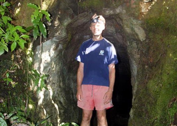
A short steep climb leads to the flat top of Mt Eliza, (1:30) where a breeze blows through a patch of podocarp, notably miro and totara, plus some horopito. The steep descent is still well-marked, although a bit overgrown, as the track zig-zags down to a few prospecting drives scattered on the eastern slopes of Mt Eliza. The main gold mine entrance is signposted 50 metres away on a separate side-track. (1:45) Mt Eliza Mine
At the bottom, turn right past two signposts and cross the Waitekohe Stream. It takes a full 15 minutes to regain Thompsons Track via a steep spur track. You emerge from the bush at the tree with the yellow tape around it. The carpark is about 30 minutes down the road. (3:00)
Notes:
1) Watch out for trailbikes on Thompsons Track - they appear very suddenly.
2) It may pay to carry water, esp. across the ridge route over Mt Eliza.
3) This loop could be walked in the other direction, depending on the state of your knees.