Mt Richardson
- Easy
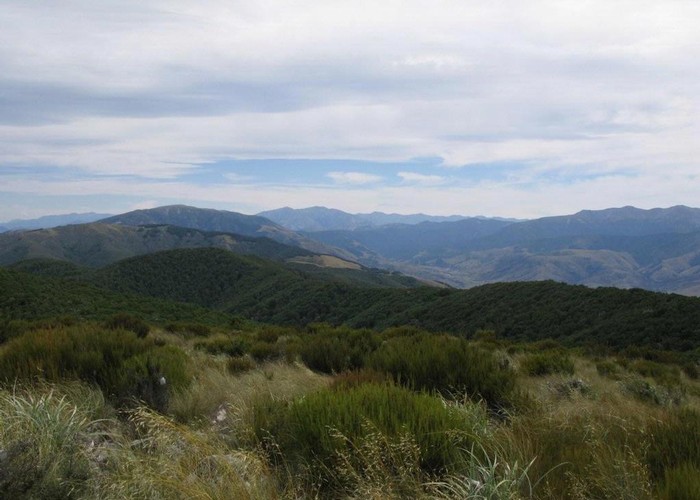
Climb up steadily on a well-made track through tawhai forest and up to Mt Richardson (1047 metres). At the top you get great views of the Puketeraki and Torlesse ranges one side, and across the Canterbury Plains on the other.
6 members favourited
14 members checked in
|
Walking time
|
|
|---|---|
|
Type
|
|
|
Grade
|
Easy |
|
Bookings
|
No bookings — open access
No — open access
|
|
Maps
|
-
|
|---|
|
Link
|
www.doc.govt.nz/parks-and-recreation/tracks-and-walks/canterbury/waimakariri-area/glentui-tramping-tracks/http://www.doc.govt.nz/parks-and-recreation/tracks-and-walks/canterbury/waimakariri-area/glentui-tramping-tracks/ |
|---|
ID 3361
About this track
231 views in the past year (19 per month).