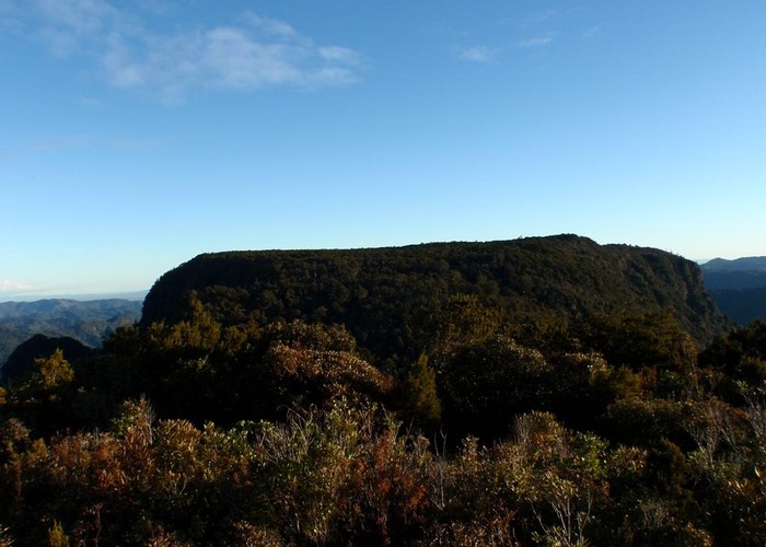
The Pinnacles, Coromandel
Coromandel Forest Park
- 5 hr – 7 hr return by the same track
- Easy/medium
Forests, falls, and formations on the Coromandel Peninsula.
|
Walking time
|
1 – 2 days
5 hr – 7 hr
|
|---|---|
|
Distance
|
15.0km |
|
Type
|
Return by the same track
|
|
Grade
|
Easy/medium |
|
Bookings
|
No bookings — open access
No — open access
|
|
Starts
|
Kauaeranga Valley Road, near Thames |
|---|---|
|
Maps
|
NZTopo50-BB35
|
|
Altitude
|
200m
–
773m
Altitude change 573m
|
An interesting track with varied terrain. Starts with a moderate slog up some stone stairs which gives you a good workout but there are also a few flat easier sections to regain composure. Also the odd swing bridge crossing for added interest. A little wet but generally a very well kept and well formed track and never a chance of getting lost.
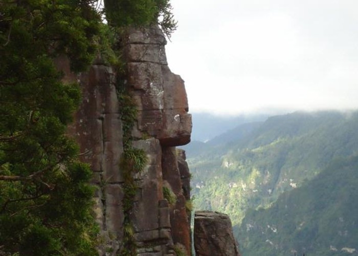
Time to the hut is 2 hours with another 50 minutes to the peak up well formed stairs and the odd ladder. Towards the top are a few steep scrambles up some rocks but nothing too major. Care must be taken if exploring the rocky outcrops at the top, there are some sheer bluffs and 'welcome to vertigo' sights to be had. Fantastic views at the top including Whangamata and Table Mountain. I would imagine the top could be a little exposed in poor weather.