Arthur's Pass Walking Track
Arthur's Pass National Park
- 1 hr – 1 hr 30 min one way
- Easy
- Village to lookout: 30 minutes
- Lookout to Jack's Hut: 30 minutes
- Jack's Hut to pass: 30 minutes
- Bealey Valley Track: 3 hours return
- Temple Basin Track: 3 hours return
- Dobson Nature Walk: 30 minutes loop
- Lake Misery Track: 20 minutes from Dobson Nature Walk to Otira Valley Track
- Otira Valley Track: 2 hours return
A new walk, opened March 2014 to mark 150 years of Arthur's Pass. Attractive and easy walking from the Arthur's Pass village to the pass itself, offering access to a variety of other tracks.
|
Walking time
|
1 hr – 1 hr 30 min |
|---|---|
|
Distance
|
3.4km |
|
Type
|
One way
|
|
Grade
|
Easy |
|
Bookings
|
No bookings — open access
No — open access
|
|
Starts
|
Punchbowl Road, Arthur's Pass Village |
|---|---|
|
Ends
|
Near Arthur's Pass summit |
|
Maps
|
NZTopo50-BV20
|
|
Altitude
|
737m
–
920m
Altitude change 183m
|
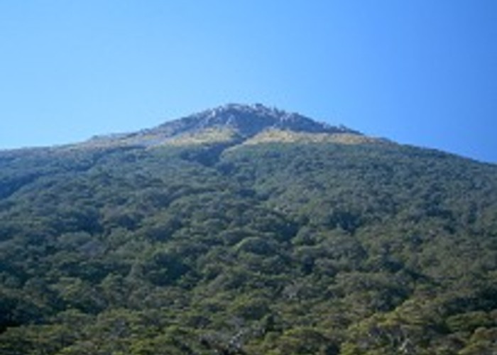
The lower section of track was originally called the "Bridal Veil Falls Track." Recently, the track has been extended and renamed, making for a satisfying and convenient route up onto the pass. The track rises gently through rich forest, native wetland, and over subalpine scrub.
Arthur's Pass was already known to West Coast Māori as a route for transporting greenstone, but was not often used. Arthur, Edward, and George Dobson set out in March 1864 to explore the headwaters of the Waimakariri and Otira Rivers. Discovery of gold on the West Coast prompted a search for a better option than the long route over Harper Pass, and Arthur's Pass was found to be the best of a poor lot. A road was pushed through by 1866.
From the Punchbowl Road car park at the northern extent of Arthur's Pass village, follow a graveled track to a footbridge over the Bealey River. Several tracks head off from here, but keep left and head into the beech forest. The track is wide and gently graded. Tall, straight mountain cedar are a feature of the track, with mountain beech, tanekaha, neinei, and Archeria also present, and the white flowers of Ourisia prominent at the track edge.
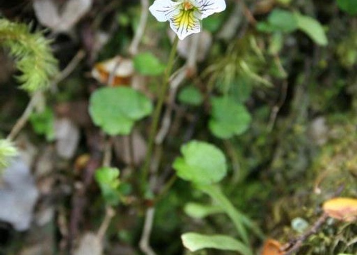
Soon, the track reaches a lookout point, with a glimpse of the Bridal Veil Falls. A steep set of stairs lead down to cross the creek before rising just as quickly. From here, the track crosses a boardwalked wetland. New Zealand's two modest carnivorous plants can be found here: sundew and the purple flowered bladderwort. From here, the track passes under power pylons and through light forest to Jack's Hut.
Jack's Hut is one of three roadmen's cottages remaining on the Arthur's Pass road (the others are at Castle Hill and Porter's Pass). It was built in 1879 and located by Rough Creek, where the village is now. The hut was moved to its current site in 1910.
Beyond here, cross the road to the Bealey Valley car park. After a couple minutes, the tracks diverge, although a side trip to the Bealey Chasm is interesting. The Arthur's Pass Walking Track continues uphill through pretty beech forest, soon opening onto a subalpine herbfield, and climbing easily to the summit. Here, it meets up with the Dobson Nature Walk.
Walking times:
Nearby tracks: