Pineapple Track - Skyline Walkway
Silver Peaks
- 3 hr – 5 hr one way
- Easy
This is an easy and popular track that gives great views of Dunedin city
|
Walking time
|
3 hr – 5 hr |
|---|---|
|
Distance
|
5.0km |
|
Type
|
One way
|
|
Grade
|
Easy |
|
Bookings
|
No bookings — open access
No — open access
|
|
Starts
|
Tanner Rd |
|---|---|
|
Ends
|
The Bullring on the Flagstaff-Whare Flat Rd |
|
Maps
|
NZTopo50-CE17
|
|
Altitude
|
190m
–
665m
Altitude change 475m
|
You can do this track from either end but I stared from Tanner Rd, which is probably not the best way as it is a steep climb.
The entrance to the track is well marked and at the start folows various roads associated with Dunedin's Water supply. After passing a final building the track enters magnificent bush.
Pace yourself because, while the track is good, it is quite steep and doesn't ease off for a while.
After climbing through magnificent bush with fantastic bird life you come out onto a grassy area about half way up where you get the most magnificent views of Dunedin City. The track carries on up into the saddle between Flagstaff and Swampy where a large DOC signpost stands at a junction. Turn hard left to go to the top of Flagstaff.
This is the top of the section called the Pinapple Track. People often ask how this name came about. The story is that a gentleman by the name of Oscar Balk used to walk up here in the 1920s. Each time he came up he would eat a tin of pinapple and leave the can on a stick. The first track markers on this track were Oscar Balk's upturned Pinapple tins.
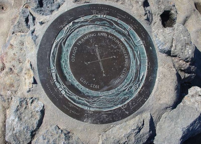
From the signpost the grade eases and you can enjoy the views of Dunedin as it unfolds in front of you. The summit of Flagstaff is marked by an upended sewer pipe with a benchmark concreted in it and a plane table which will help identify the countryside that you see on all sides.
The descent to the bullring is an easy gradient and only takes about 30 mins.
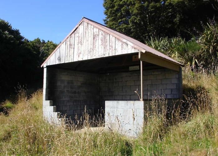
A side trip that you might like to take is to the Ben Rudd's picnic shelter. Ben Rudd was a hermit who lived on this side of Flagstaff in the 1930s. On his death the land was aquired by the Otago Tramping and Mountaineering Club who retain ownership to this day.
To get to the shelter you will need to locate a cairn beside the firebreak that runs parallel to the Skyline walk. From there a rough and overgrown track leads to the shelter.