Wakamarina
- 7 hr – 8 hr one way
- Easy
An old goldminer's trail crossing the Richmond Range from Wairau Valley to the Wakamarina Valley.
This is an easy 2-day walk or a long 1-day walk.
|
Walking time
|
1 – 2 days
7 hr – 8 hr
|
|---|---|
|
Distance
|
15.0km |
|
Type
|
One way
|
|
Grade
|
Easy |
|
Bookings
|
No bookings — open access
No — open access
|
|
Starts
|
Kiwi Road |
|---|---|
|
Ends
|
Butchers Flat, 15km from Canvastown |
|
Maps
|
NZTopo50-BQ27
|
|
Altitude
|
1,066m |
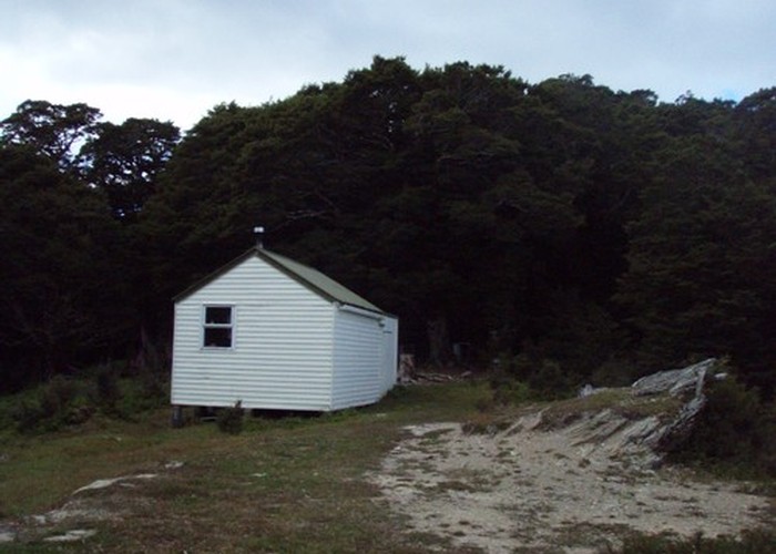
The track follows a mostly gradual ascent from the carpark on Kiwi Road to Fosters Clearing. From here a sidetrip can be made along the ridge to Fosters Hut about 10-15 mins away.
From Fosters Clearing the track descends to the top of Fosters Creek then regains all the height lost as it climbs over a knob. The bush understorey is quite bare here and there is a lot of sign of pigs. The track zig-zags for some time as it drops to the valley floor where it meets the track heading to the old stone miners huts (1 hr 30 mins return). Devils Creek Hut is 5 min away.
It is an easy 2 hours from Devils Creek Hut to Butchers Flat carpark following the Wakamarina River. The last 30 minutes is on a broad 4wd track.