Leslie-Karamea
- 3 – 4 days one way
- Medium
Joins onto Wangapeka Track.
|
Walking time
|
3 – 4 days |
|---|---|
|
Distance
|
91.0km |
|
Type
|
One way
|
|
Grade
|
Medium |
|
Bookings
|
No bookings — open access
No — open access
|
|
Starts
|
Flora Car Park |
|---|---|
|
Ends
|
Trevor Carter hut (joins with Wangapeka) |
|
Maps
|
NZTopo50-BQ24
NZTopo50-BQ22 NZTopo50-BQ23 |
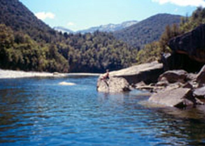
The Leslie-Karamea is a less popular route through classic West Coast bush through the Kahurangi National Park, travelling along the Karamea river for some distance. At times the track is close to the Karamea, and therefore should not be attempted if heavy rain is forecast, given the volumes the river can carry. If you choose to do so, be prepared to camp up if necessary. Most rivers are bridged but there are some large creeks that can carry large volumes after rain. There are plenty of huts and while it took us 5 nights, it could be completed at a much more leisurely pace and staying in each hut a night.
Rare bird life is seen in the area, including roroa (kiwi), whio, kaka, and kea. The route can be rough in places but is largely well-formed and marked. The area is popular with fishermen who walk or helicopter in to try their hand at catching some of the brown trout that can be spotted in the clear waters of the Karamea.
Trampers have the option of starting/finishing at either the eastern or western end of the Wangapeka track, although the eastern end is the more common. I have only walked this route finishing at the western end and beginning at Flora, so my notes will reflect this, and include the Western section of the Wangapeka track.
Day 1: After making your way up the steep and narrow road to Flora Car Park, make your way up the clearly marked (but closed) 4WD track past the shelter. Follow this track past the historic Flora hut as well as a number of well-marked shelters. If you have the time, whio are often reported in the area of Flora hut so have a nosy in the creek while you are here. Continue along the track as it narrows, until it becomes a well-marked walking track. You will see three rock shelters, any of which is a comfortable stop for a snack or lunch. Continue up above the bushline and make your way to Salisbury Lodge (serviced, 22 bunks) - tramp is approx 3 hours. This hut has a gas stove provided but is popular - it might be a good idea to get there early and then take one of the short walks among the tussock to make sure you have a bunk. As an alternative, trampers can take the Mt Arthur track up to the Mt Arthur hut before continuing along the tops to Salisbury Lodge.
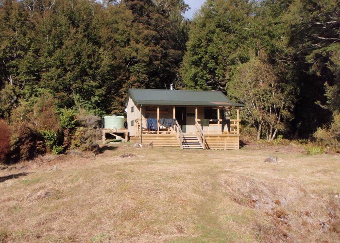
Day 2: follow the track uphill onto the Tablelands. This area can be blanketed by cloud or rain due to its height, but fortunately you are not exposed for long before dropping down off the tops into a moderately steep scramble down into the Leslie valley. Navigate your way down until you reach the fabric-sided Spludgeons shelter (5 bunks), a great spot for a snack. After recovering, continue down the valley to the flats. At times this track can become overgrown with beech and the markers be hard to spot, but a short exploration will find you back on track with minimal trouble. Travel becomes easier as the route flattens and widens out, and approximately 6.5 hours after leaving Salisbury, you will arrive at the Karamea Bend hut (standard, 22 bunks), on the true left of the Leslie near its confluence with the Karamea. Be warned: this hut has the most aggressive and prolific sandflies I have ever experienced, beating out Stewart Island and Fiordland for this dubious honour! The hut sits on a sunny terrace overlooking the Leslie and is modern and warm, with two toilets and a log burner. Kiwi could be heard calling in the bush behind the hut at night, and weka are common.
Day 3: follow the marked track along bush terraces on the true right of the Karamea, past the old Karamea Bend hut (now locked and used only for DoC staff). The track will lead you to Crow Hut (standard, 12 bunks) without any significant issue. Crow hut is again a modern hut with all DoC's usual features, and a comfortable place to stop for a bite. Make sure to check if any fishermen have left goodies inside as we scored a number of tasty condiments to help our Dehy slide down...
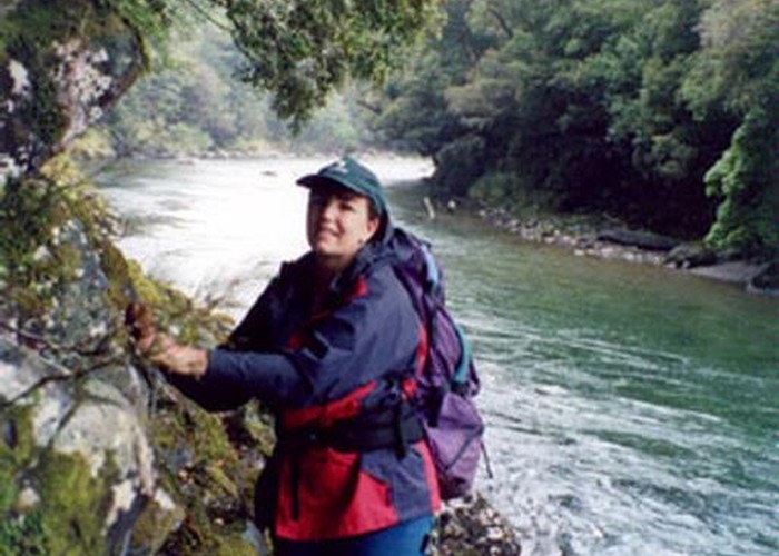
Continue along the true right from the hut to a swing-bridge to cross to the true left bank after about 3.5 hours from Karamea Bend. Before the swing-bridge is a boggy section for approximately 15 minutes, so be prepared for heavy going. On the way to the swing bridge, the track drops down to the riverbed twice, climbing up side branches or tributaries of the Karamea, before going back onto the terraced hillside. These sections are poorly marked and it can feel like you have overshot the re-entry - both tracks coming into the side-stream and exiting are on the true right of the stream bed, and are very clearly marked so simply keep walking until you see the big orange triangles.
After crossing the Karamea bridge, continue along the true left in much the same fashion until reaching Venus hut (standard, 12 bunks). There is a nice calm pool in the Karamea upstream from Venus creek, ideal for a swim or washing off the mud from the boggy sections. To reach the pool, head from the hut to the rocky point at the confluence of the Venus and Karamea - a rough track down can be found near the supporting cable for the bridge by the hut.
Day 4 (never again!): strike out upstream on the true left for more terraces, today interspersed with a few patches of riverbed navigation. There is one exposed section of benched rock directly above the main flow, however there are hand chains rigged, and apart from the slippery rock this is a simple section but will likely be impassable after heavy rains. Wander along until you hit Thor hut (standard, 6 bunks), around 3 hours after leaving Venus. This SF70 hut may be your base if it has been raining. Stop here for a bite, or continue upstream.
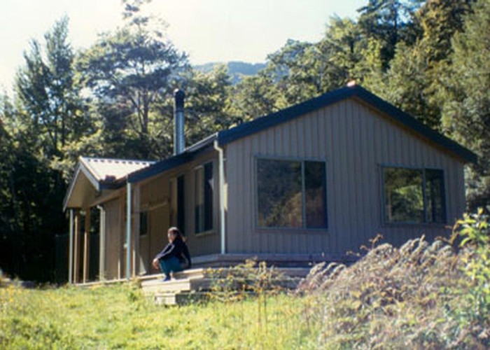
Approximately an hour from Thor Hut lies Mars creek. This is an easy crossing in the dry, but a sign of what lies ahead - if this creek is up or at all difficult, turn around and return to Thor Hut to wait it out in relative comfort. Further ahead lies Kendall creek, a major tributary to the Karamea with a large catchment. The Kendall WILL be impassable if Mars is difficult so save yourself a soaking and wet wait. If Mars is fine, keep on walking upstream to the Kendall then across this. After the Kendall the track loses its way in boggy patches and windfall, but approximately 3.5 hours after leaving Thor, you should reach the Trevor Carter swingbridge. Cross this and backtrack down the true right to the large Trevor Carter hut (standard, 12 bunks), one of the nicest huts on this entire route and the meeting point with the Wangapeka track. To head to the eastern end of the Wangapeka, head over Biggs tops (steep and inadvisable to do so from this side but fine from the other, or via Lost Valley to Helicopter Flat hut.
Alternatively, you can choose not to cross at the bridge, and continue heading west along the true left bank of the Taipo river. Be warned however! What looks nice and gentle on the topo is in fact the remnants of multiple rockfalls from the 1929 Murchison quake. There is therefore a decent amount of rock hopping as well as root-covered sections, and on tired knees or legs, this can be rough as well as taking significantly longer than the posted 2:45 from the bridge. We eventually trudged into Taipo hut (standard, 16 bunks) 10.5 hours after leaving Venus, not counting meal stops. Maps suggested a total distance from Venus to Taipo of approximately 22km over variable terrain.
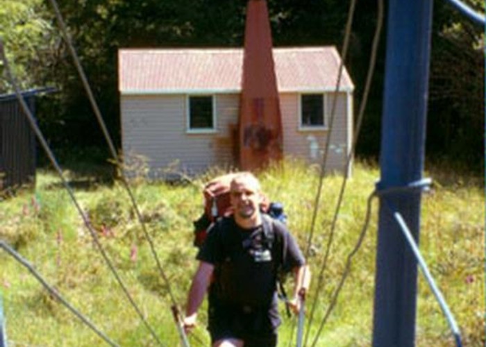
Taipo hut is based on the old NZFS design and very welcome after a long day, however there is nothing special about this. The one benefit that a long day provided was in cutting down day 5, which would otherwise have likely been even longer. The track to the hut is still well marked and formed, however the lesser popularity of this end is evident as rocks are slippery from lack of boots keeping the moss off, and logged boggy sections have started to rot without being repaired.
In hindsight, unless you want to put in some long days from Venus to Taipo or Trevor Carter to Belltown, I would instead recommend staying at Trevor Carter, then taking a scenic route to Taipo via Saxon falls (or even Helicopter Flat hut if you want a longer day).
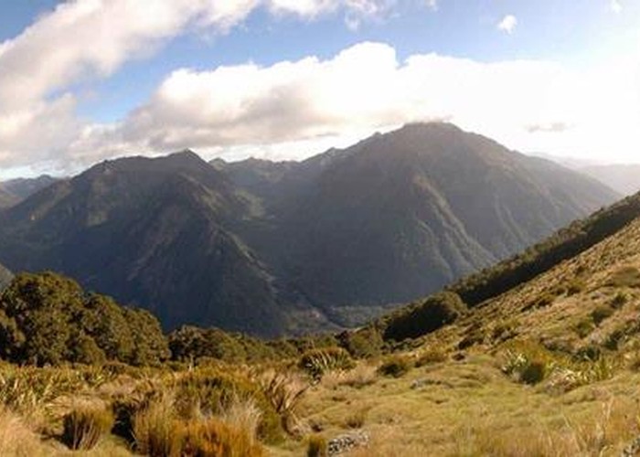
Day 5: continue up the rocky slopes towards Stag Flat. The climbs become steeper before reaching the open flat and the 2 bunk shelter here - approx an hour from Taipo. A brief open section then dip back into the bush for a short, sharp climb up to the Little Wanganui saddle and some more open air! Sadly cloud had come in and views were limited, so we plugged on down past two tarns and dipped back into the bush - in clear weather the coast can now be seen.
The descent is again moderately steep and rocky, crossing obvious old rockfalls - a bit hard on legs and knees still feeling the previous day. Two hours descent from the saddle brings you to the Little Wanganui shelter, which is a standard two bunk biv with a long drop. Grab a bite, then continue down, crossing a swing bridge over to the true right bank of the Little Wanganui river. The track becomes easier as you descend, however windfall from cyclone Ita in 2014 causes the track to divert up and down at times. After 1.5 or so hours, you reach Tangent creek. As with Kendall creek, this is dangerous after rain, however there is a swingbridge located upstream to get you across in one piece. As of Jan 2017, a tree had fallen over the sign on the eastern side of this creek directing you to the bridge, however the creek has a sign naming it and so if it is high, head upstream and you will find the bridge easily. Across the creek, the track climbs up above a section of major windfall and going gets slow as you navigate a very rough passage of a km+. After dropping back down, two more hours of generally mild downhill leads you to Belltown-Manunui (standard, 10 bunks). There is a small stream by the hut for fresh water, and a resident pair of weka. There also unfortunately resident rats in the walls, however DoC have been made aware and will hopefully sort this quickly.
Update 2022: the old Belltown hut has been replaced by a new Belltown Minonui
hut, approximately 1km further west.
Day 6: cross the small stream and continue down the true right. Early on are some exposed areas above old slips and windfalls, however the track reaches flat grassland after an hour and fast progress of 4-5kmh is possible. Follow the clear track to the road end, but be warned that the first road sighted is actually a driveway and a short walk is needed before you reach the car park. This should take no more than 3.5 hours and is the easiest day of them all with an almost empty pack. Load up and hit the Little Wanganui pub on the way home to rehydrate!