Okuku River - Pinchgut Hut
- 4 hr return via same track
- Easy/medium
An easy day walk or overnighter to a hut in the foothills behind Mt Thomas
|
Walking time
|
1 day
4 hr
|
|---|---|
|
Distance
|
12.0km |
|
Type
|
Return via same track
|
|
Grade
|
Easy/medium |
|
Bookings
|
No bookings — open access
No — open access
|
|
Starts
|
Fox Creek, Taaffes Glen Road, Whiterock |
|---|---|
|
Maps
|
NZTopo50-BW23
|
|
Altitude
|
200m
–
360m
Altitude change 160m
|
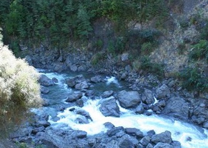
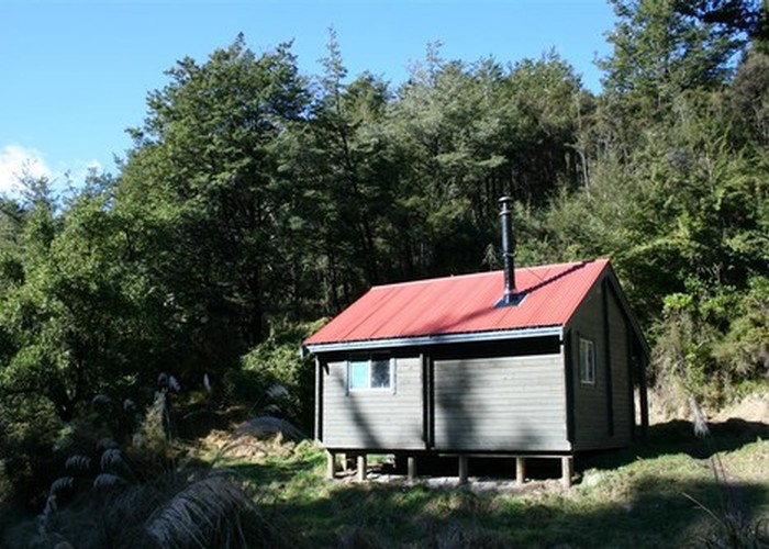
This track sidles along the true right bank of the Okuku River to Pinchgut Hut, one of the closest backcountry huts to Christchurch. The hardest part is finding the track beginning.
Follow signs to Loburn, then Loburn North, then Whiterock. Watch for the Taaffes Glen Road turn off just after a single lane bridge. This shingle road leads through the Whiterock Downs Farm and over a ford. Eventually the hills close in and the river flats run out. Park at the last river flat paddock, just before the trees drop down to the roadside.
Head up the road 10 minutes to a small ford, where the road drops close to the Okuku River. Ford the river, which may be quite deep and swift. The track starts here. A sign by the track indicates that the time to Pinchgut Hut is "4-6 hours" -- this is incorrect.
The easy track leads past a few beehives and bends right to meet an old 4WD track. This is followed a little way, and the track soon drops onto the river stones briefly, to begin sidling. The trackside is rich with kowhai and the leafless Clematis afoliata.
1 hour from the start, the track drops onto the riverbed at Whare Stream. There is some clambering around boulders and perhaps a little wading here. The track takes up again just along from Whare Stream, and climbs the hillside. The track continues easily to the hut, passing through a section of kanuka and gorse just before meeting the wide, old track and dropping a few metres to the hut.
The hut itself is located in the frosty valley of Pinchgut Stream. Some camping is available on flats across the stream.