
Route Guide: Richmond Ranges (east)
The Richmond ranges stretch from Picton in the East to St Arnaud in the west, bordered by the Queen Charlotte Track in the north, and the Wairau valley to the south. The north-south Kaituna river valley between Havelock and Renwick divides the eastern and western sections of the range, carrying SH6 and interrupting what is otherwise a continuous extent of crown land and unbroken tramping country. The eastern ridges get almost no visitors – except for occasional pig hunters based at Cullens Creek Hut.
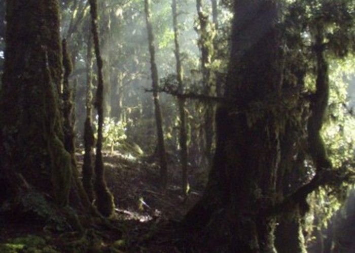
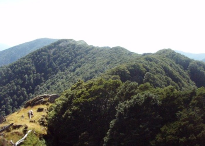
East of SH6, the ranges are low, with the ridgline hovering around the 1000m mark. Ridgeline tramping is almost entirely through mature beech forest, with short scrub sections. Half-a-dozen clear tussock-clad peaks provide brief views of the Sounds, but this is predominantly bush tramping. For high peaks and continuous views, consider the western Richmond Ranges.
The ranges east of SH6 have no DOC facilities, and the only private hut in the area (Cullens Creek Hut) is locked and has no indication of who to contact for access. Camping is thus the only option in the eastern ranges, and water can be a problem in summer with most smaller creeks drying up and 700m descents to the main waterways a necessity to replenish supplies.
There are 2 main options for tramping here:
· The 1 day north-south Waikakaho-Cullens Creek track. This is a benched track suitable for all abilities.
· A 2 day east-west traverse along the ridgeline between Picton and Okamario. This can be combined with the main ridge of the western ranges to make a 10-day walk from Picton to St Arnaud. This in an unmarked ridgeline route with some scrubby sections and routefinding skills are a must.
Access: Eastern Richmond Ranges
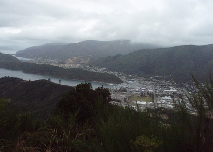
Access to the eastern end of the Richmond ranges is from Picton, up the track to the Mt Freeth TV tower. This is not a legal road, but appears to be open at least to foot traffic.
To the north and south, legal access is available to the Waikakaho-Cullen Creek track from Waikakaho Road in the south and Cullensville Road in the north.
At the eastern end – things are clear legally, but more murky on the ground. Legal access if off Waikakaho Road or Kenningtons Road – which continues as a paper road over the saddle to join the Wakakaho Road at the confluence of Waikakaho River and Dukeshead Stream.
· A branch of the paper Kenningtons Road leads to the forest park boundary just before the climb to the saddle (P28 797792).
· Dukeshead Stream has a legal marginal strip, and can thus be legally traveled down as far as the Waikakaho Road.
· A legal (paper) road leads from Kenningtons Road to the forest park at P28 763772.
The above legal access points are shown on this map.
However – neither of the above roads are visible on the ground – and landholders may not be aware of (or willing to acknowledge) their existence. You may be better asking for access permission of the Jorgensons who own the valley.
Bus transport is available to Kenningtons Road on SH6, and to Picton.
East –West Traverse
Picton to Waikakaho-Cullens Creek track: 7-14 hrs, 16km.
An easy 600m climb up 4WD tracks to Mt Freeth. 13km along an easy-moderate unmarked but well traveled ridgeline route in mature beech. A short, scrubby section at the start.
Probably the most pig-sign I’ve seen in NZ – hunters take note! Note that there is no water on the ridgeline. A compass is recommended, especially in bad weather.
From Picton climb the 4WD track to the Mt Freeth TV tower (the tower at the summit of the hill, not the one half way up). 1hr30, 3km
Continue SW a few meters into the bush beyond the TV tower and you’ll pick up orange / pink markers (paint blobs on trees) heading NW along the ridgeline. The route follows the ridgeline and is scrubby but passable for the first 1.5km (to P27 905897). Beyond here it’s into mature beech and much more pleasant going. Several of the peaks stick above the bushline, and give views of the sounds. Follow the main ridge, taking care at the southern peak of Mt Duncan to select the southern ridge towards the Waikakaho – Cullen creek saddle. A compass will probably be required as several knobs have multiple ridges descending from them. 7 hrs, 13km.
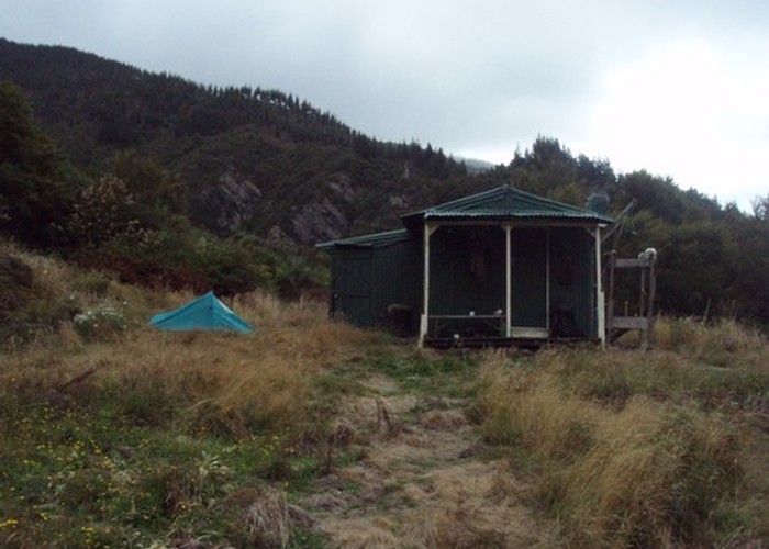
Unless you’ve obtained the key for Cullens Creek hut, camping will be your only overnight option. In summer it will probably be necessary to descend 3km / 600m down the benched Waikakaho-Cullen Creek track to the hut if you require water. There’s no permanent water on the Cullens Creek side above the hut.
Waikakaho-Cullens Creek track – SH6 (Okaramio)
14km of easy ridgeline travel in mature beech – becoming moderate-hard, scrubby going beyond pt1045. 4-6km on gravel road to reach SH6. Note that there is no water on the ridgeline.
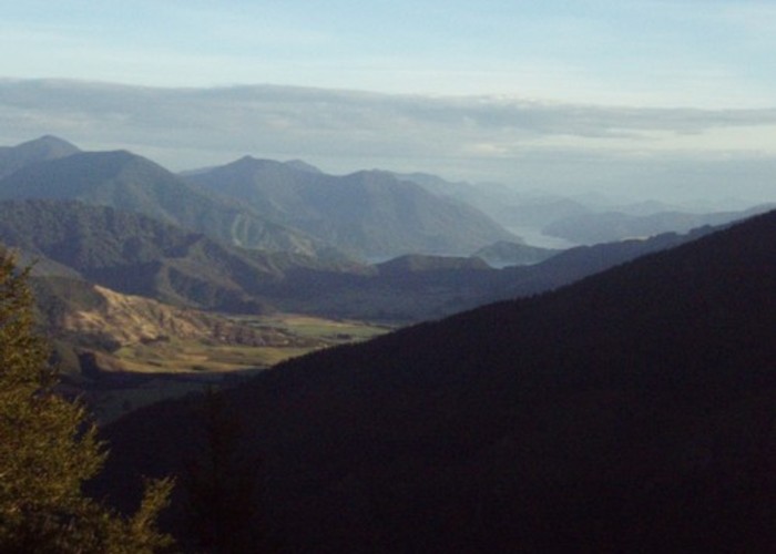
From the Waikakaho – Cullen Creek track at the saddle, a well traveled route (with sporadic orange/pink paint markers) runs WNW along the ridgeline to Dukeshead and Mt Cullen. From Mt Cullen, the well-traveled route and occasional markers continues south as far as pt1045, where it rises above the bushline for the 1st time, giving views of Havelock, Blenheim and the Sounds. 4hrs, 9.5km
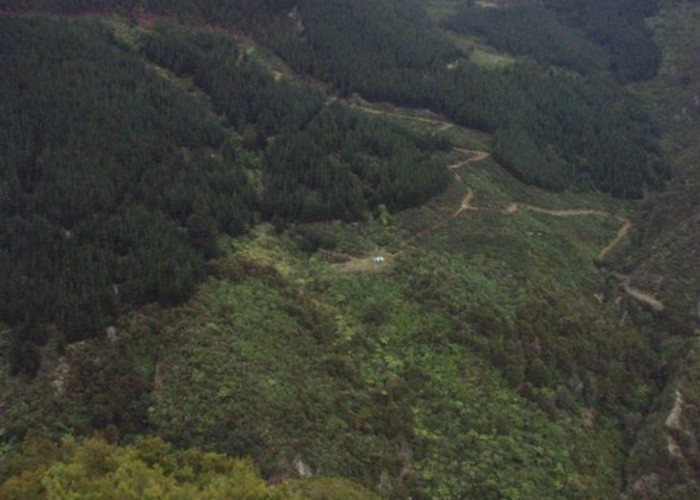
Beyond pt1045 it gets progressively tougher, with stunted, closely packed beech becoming common. The marked route continues, but can be hard to follow in some places, and you are probably best finding your own way. Descend your chosen ridge to Kensington Road – good ridges lead down from pt 867. Whilst paper roads lead to the park boundary, you may wish to ask for access permission. 3hrs, 5km
Follow Kenningtons road to SH6. <1hr, 3-4km
North-South traverse: Waikakaho Cullens Creek Track
A day walk along a benched, well maintained track. A steady 600m climb / descent to the saddle. Principally regenerating bush and pine forests, with a section of native bush at the saddle.
I’ve only walked the Cullens Creek side of the Waikkaho-Cullens Creek track, but can confirm that it is a well maintained, benched track suitable for all abilities. It’s about 11km from Cullensville roadend to Waikakaho roadend, and as such should be a reasonable day walk. The track is benched about 200m above the river as far as Cullens Creek hut, (private and locked – though camping may be possible nearby). From here it climbs to the saddle in a series of gentle switchbacks through first pine forests and then native beech.