Turiwhate Range from the South West

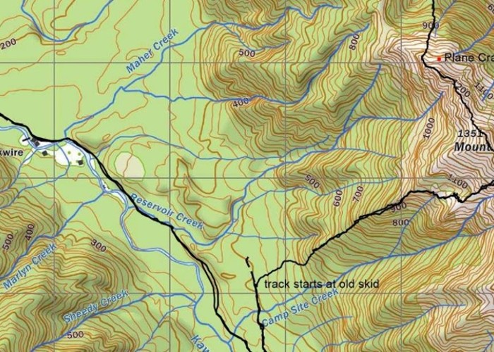
On Sunday I walked up Mt Turiwhate from the SW. Historically the range has usually been accessed from the NW or N side. Recently some rock climbers have cut and marked a new route to the tops from off the cycle way that runs alongside Kawhaka Creek. This newish track starts off an old skid site on the old logging road which meets the cycle trail a little SE of Camp Site Creek. (see map)
This route like the others up the range is reasonably challenging but it offers another walking route and spectacular views.
Comments
-
 glennj My map is best viewed in wide screen. The pointer on Google Maps shows where a granite pinnacle is located on a side ridge near the uphill end of the new cut and marked track.
10 October 2023
ID 17269
About this photograph
License
All rights reserved
140 views in the past year (14 per month).