
With rain forecast over Easter close to the main divide Frank and I looked for possibilities further east. He came up with this suggestion as he’d wanted to do a south/north traverse of the Black Hill Range which lies to the west of Mt Hutt. I was keen to travel down the Nth Ashburton River from Comyns to Cookies Hut so the trip ticked the boxes for me. I particularly wanted to see what Totara Camp looked like. We checked the rainfall data on the ECAN site and it looked as though the flow would be low enough to do the trip. It was flowing between 4.6 and 5 cumecs for the journey.
We had planned to go down from Comyns to Boundary Stream at Xmas one year but the river was still up and Frank wasn’t happy to try pack floating it. I find being thwarted seems to increase your enthusiasm for completing the trip.
On the way in from Glenrock road end, we met a hunter who we’d shared a hut with in the Hurunui some time ago and had a chit chat. He’d shot a chamois and it looked he’d got a trophy plus meat. He told us a bunch of quad bikes and a motorbike had passed him heading for Comyns Hut so we decided to stay in A-Frame Hut. Although it is a cozy warm hut I don’t like it as the windows are opaque so it feels like a prison cell to me. We had a warm night there with the nor’west though fine and sunny on the walk in.
The next day was windy and overcast with very light rain that didn’t require putting on a raincoat for. We went down to Comyns and the hunters had taken all their gear out of the hut but left their quad bikes there. We began the descent of the river and found it easy travel to Boundary Stream. There were a lot of deer prints but not much poop. I noticed a very black small pig grazing on the bank that Frank was about to climb up to and I stood on a boulder to watch the surprise encounter. We didn't really have to link up for the crossings.
We stopped for lunch just before Kings Drive and soon after that passed what was obviously Totara Camp. Here, there was an impressive small forest of Hall’s Totara though it was quite gloomy underneath. Across the river was an overhang with a cairn built at the entrance but we were too focused on checking out the camp to investigate this other feature. There was a tarp folded up with guy ropes stashed at the camp. It would be good to stay there on a frosty evening. Apparently cattle used to hang out there when the Ensors got away with letting them run on conservation land.
We carried on down to Boundary Stream where the character of the river changed as it became steeper, I noticed a nice clearing to camp in on the true right where someone had cut the upstream entrance back. The river was still easy to cross solo but there was one place where we backed off and took another look for an alternative. At one point we climbed over a low point in a terminal spur just for a fun shortcut. Here we saw 2 goats on the cliffs. Lower down in the river there were numerous prints everywhere.
By this time we felt the cooler air of the southerly change in our faces but we knew once we turned the corner to travel up the Swift it would be warmer. We looked to see which feature would be the Rock Pillar marked on the map and decided it was an island of rounded rock. Frank and I are keen to come back to this point via Lagoon Hut sometime.
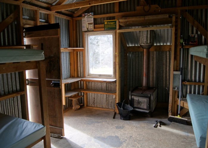
It was easy travel up the Swift to Cookies Hut. Luckily there was no one staying there. Hunters had generously left a lot of firewood and coal but I went to the edge of the clearing and gathered a heap to make a fire for the evening and the following morning as there was a dead matagouri hidden in the undergrowth. It was a clear night with a slight frost and I got chilled in my very light sleeping bag. At one time I dreamt the land had suddenly been swept with a freezing phenomenon so I woke and put on my downie.
In the morning I relit the fire then woke Frank up to a warm hut. I am a good squaw and he is a good packhorse. We had a long day ahead traversing the tops back to A-Frame hut via Point 2109, coming down on to the true left of Comyns Stream. I started ahead of Frank directly behind the hut up the spur to point 1035. Fortunately hunters with their frequent passing had ensured there was a gap among the matagouri. By an old fenceline I startled a feral kitten which was around 6 months old. It was a sleek looking pale almost fluffy tabby. Let’s hope it was sleek from eating the plentiful skinks not birds.
We traveled on until Frank called for a halt after a climb of 700 metres. He said this was half the height gain we had to do. He had a drink and I had a snack and then we carried on along the easy rounded ridgeline for another 400m to point 1802 for lunch. There was an ancient trig point which we sheltered against though a chilly gentle breeze did find us.
Gentle undulations took us to the Turton Tops and after a stiff unwelcome climb to point 1808 we dropped then sidled to the 1820 contour line past the first spur to the first tarn marked on the map. I was a bit faster than Frank with my lighter pack and volunteered to drop to this tarn and fill my 2L platypus with water to share. Unfortunately I spied a tarn which seemed unexpectedly lower but I couldn’t spot an alternative so dropped down on large fairly stable talus. At one stage I took to a strip of fell field and heard water under the rocks which unfortunately was inaccessible. This made me suspect there was a body of water I’d missed but I carried on down to the certain small tarn.
It was sheltered from the wind and surrounded by level non- boggy vegetation and would make a good campsite. The water tasted sweet and I had a couple of cups and then filled my bag and made my way back up to catch Frank up on a gradual sidle to a small col 600m west of point 1861 where we would regain the ridge line to the highest point of 2109. I spied Frank who seemed relieved to see me. He had sidled until he came into view of the upper tarn I hadn’t seen and been perturbed that I wasn’t there. He’d called my name until he became hoarse but the bluff that sheltered the lower tarn had blocked his calls.
I’d descended 80m unnecessarily but the lower tarn was a good campsite whereas the upper tarn was surrounded by rock and the water didn’t taste as sweet. We began our gradual ascent of the basin and found 2 more tarns. They may have been ephemeral because we’d had a decent lot of rain over summer. One was at the head of the stream draining the basin. I checked in with Frank to see if he preferred to camp and continue the traverse the next day but he was confident we’d reach the A-Frame hut before it got dark. I was glad as my sleeping bag wasn’t warm enough for camping out at this time of year.
The talus was consolidated and easy to ascend. Frank went in front and set a nice regular even-stepped slow pace to the col. Here I needed another snack so rapidly scoffed a packet of tuna in the disappearing sunshine. We carefully sidled to the ridgeline and I was relieved to see that travel was straightforward on the sunny side with gendarmes either easily bypassed on the west or even climbed over. Frank went ahead and kept to the ridgeline as much as possible as footing was more consolidated than sidling under rough sections of ridgeline.
I could see the ridgeline that runs north from Point 2109 that we were going to travel down but Frank chose not to sidle to this but head right up to the summit. Maybe because last time we were here we’d bypassed the summit on its northeast face to travel to Shingle Hill. From the summit I could see that a sidle of all the basins would have been pleasant travel but Frank wasn’t convinced though he conceded our route along the ridge from the col to the summit had taken us longer than expected.
From point 2109 we retraced our former route to point 1959. I was mystified at the 50m climb as my map had omitted the contour lines but realized eventually. We continued the descent to 1504, being careful to select our intended spur to take us down into Comyns Stream. The sun was getting close to disappearing behind a ridgeline to the west. After this we would have half an hour of functional daylight where we could travel without torches.
We chose this spur because there were gentle broad sections of descent. There were a lot of cut and poisoned pines up there from the Conifer Calvary (sic)! But unfortunately more are growing back plus they missed some on our route down the hill. Upon observation from the A-Frame Hut the spur to the southwest of point 1504 with the poisoned pines looks better then the other spur to the right of it which we had chosen as this pine-infested spur had more scree sections so would have been faster.
We got down to the hut at 7.15 pm after less than a 10 hour day with leisurely stops along the way. Total height gain was 1800m and descent was 1400m. Once again the wee hut was empty so we settled in for another cozy claustrophobic evening. In the morning it was overcast with an easterly breeze. I heard the kek kek kek of one falcon chasing another. We packed up and pushed off back to the roadend. After we dropped down from Turton Saddle we found a sheltered spot for lunch and shortly after encountered a Te Araroa traveler. He said there was a young independent woman traveling not far behind though they were both moving slowly as they were carrying heavy packs.
We saw her across Glenrock Stream having her lunch in the scrub and murmured hi but she may not have noticed our greeting in her solitude she was enjoying. A nor’west was brewing as we reached the car and rain was starting to form upstream in the river valleys. We were happy with our choice for the Easter break particularly as there were severe traffic jams in other parts of the South Island.