
Paradise shelducks are common, noisy inhabitants of the flats. Beyond Hawdon Hut a visit to Walker Pass on the edge of the Otehake Wilderness Area is very worthwhile.
Access
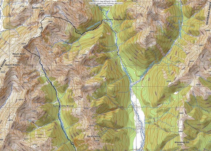
Turn off the West Coast Road (SH 73) to the right at Goldney Saddle, just before meeting the Waimakariri River. This is the Mount White Station Road, which soon leads down and across the river at the Mount White Bridge. Turn right off the bridge and drive downriver a couple of hundred metres to a junction where a sign indicates the road left leading to the Hawdon Shelter. There is ample parking and camping space here where the beech trees begin at the edge of the national park.
Bus transport is available along the West Coast Road to Goldney Saddle, or by train to the Mount White Station Bridge. It is probably an hour's walk to the shelter from there.
Hawdon Shelter-Hawdon Hut: 2-3 hr, easy + river crossing + route unmarked
There are various segments of track along the Hawdon valley. It makes little difference whether you use them or not as travel is easy over the flats.
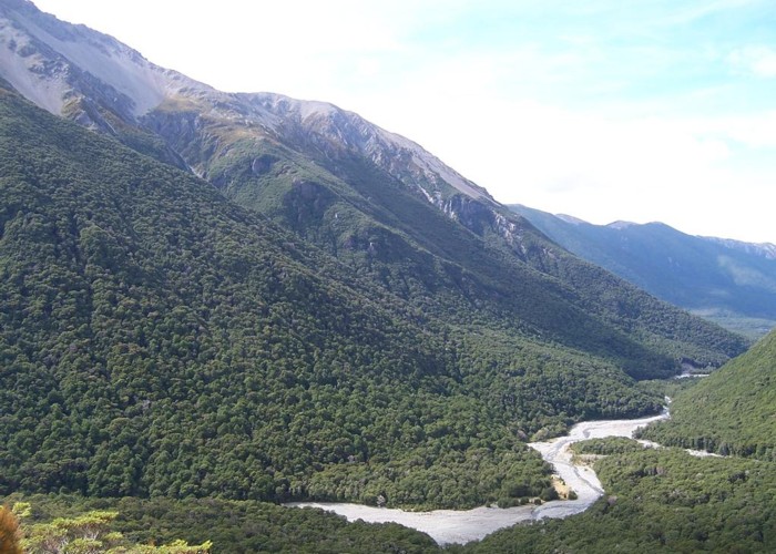
From the shelter a vague and unnecessary track heads through the beeches and down to the river. Facing toward the Pyramid, cross the river. Where an electric fence crosses the valley after a few minutes, a stile is located on the true right. A couple of minutes of river flats leads to the Sudden Valley Stream entering from the true right. From here a vague track crosses the grassy river flats and then enters the mossy beech forest. You can take this track or continue on the flats. The track sidles at the edge of the flats above a sparkling, babbling tributary of the Hawdon, with riflemen, fantails, bellbirds and parakeets audible. Beyond shingle bluffs on the opposite bank (45 min.), the track deteriorates and disappears. Drop down to the river flats and cross over to the flats on the true left. You can pick out the prominent river valleys north of the Pyramid from here.
The flat eventually runs out after 1½ hrs. near where the East Hawdon Stream enters from the true left. As the river bends around the Blackball Ridge it changes its character: the valley sides close in and the riverbed becomes bouldery with some deep pools. Kea may be heard crying overhead, visible only as tiny black dots high above the valley. Cross to the true right 5 min. above the confluence, where a track sidles easily to the hut.
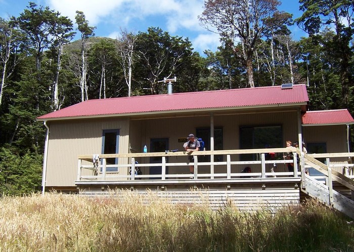
Hawdon Hut is located in a glade just metres from the river with ample secluded campsites in the vicinity.
Hawdon Hut-Walker Pass: 2-3 hrs return, easy-moderate + river crossing + route unmarked
Beyond Hawdon Hut the track to Walker Pass provides slightly more challenging travel and some good views. The intermittent trail along the riverbed and through the bush leads to a wide shingle bed where Discovery Stream descends from the true right. A track enters the forest on the far side of Discovery Stream and soon crosses a creek amongst the trees: this is Twin Fall Stream. The track stays in the vicinity of the stream as it climbs quickly up the steep valley wall. A remarkable viewpoint provides a close view of the twin falls descending side by side into the bush below. Soon the track enters sub-alpine vegetation and becomes a scramble over roots and stones. After 45 min the top of the climb is reached with excellent views along the gentle slope of Twin Fall Stream to Walker Pass, and views back into the Hawdon valley 250m below.
From here poles mark the route down to the stream and then along its sinuous curves to the large tarn at Walker Pass.