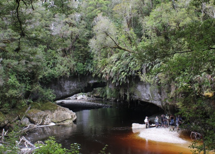
Moria Gate Arch
Kahurangi National Park
- 1 hr 30 min – 2 hr loop track
- Easy
A short walk in the Ōpārara Basin, exploring the Moria Gate limestone arch.
|
Walking time
|
1 hr 30 min – 2 hr |
|---|---|
|
Distance
|
3.8km |
|
Type
|
Loop track
|
|
Grade
|
Easy |
|
Bookings
|
No bookings — open access
No — open access
|
|
Starts
|
Ōpārara car park, McCallums Mill Road, Ōpārara |
|---|---|
|
Maps
|
NZTopo50-BP22
|
|
Altitude
|
162m
–
221m
Altitude change 59m
|
This short family walk visits one of three limestone arches on the Ōpārara River then crosses over the top to meander in a loop past Mirror Tarn and back to the car park.
Drive north out of Karamea toward Kōhaihai and turn onto McCallums Mill Road. This long and winding shingle road climbs through forest before dropping into the Ōpārara Basin, with car park, lunch shelter, toilets, and friendly weka.
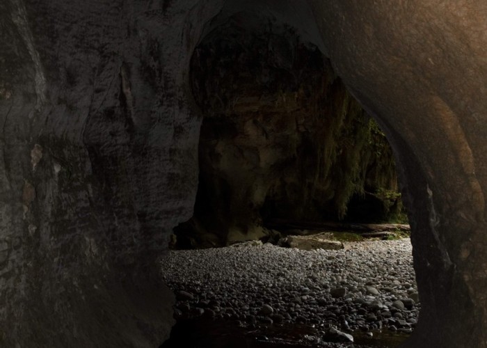
The track leads through original forest for about 20 minutes, before arriving at a junction. A short track off to the right leads to a rocky hole. A chain is provided to help you descend into the cave beneath the Moria Gate Arch. It is a clamber, but reasonably easy.
The arch draws its name from Tolkein's Lord of the Rings, and was only named in 1984. It is 46m long, 8m high, and 28m wide, making it the smallest of the three arches.
Back above ground and back at the junction, the main track leads off to climb over the top of the arch and cross the Ōpārara River. A good viewpoint is nearby. The track looks through forest easily, and passes Mirror Tarn with its forest reflections. Back on the road, turn left and head down to the car park.