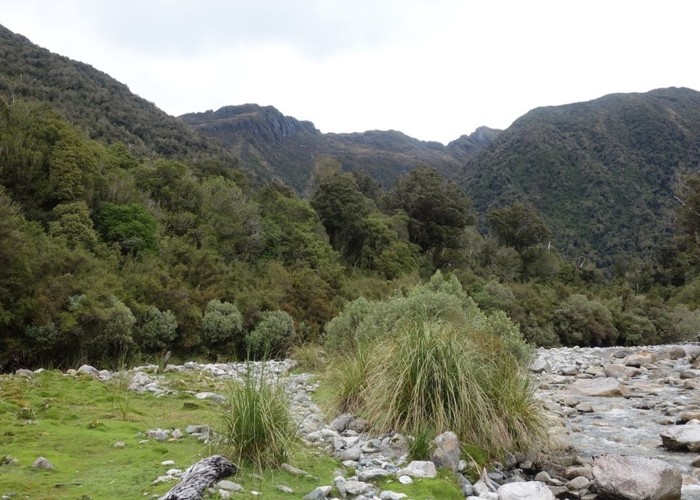
Eastern Hohonu River headwaters

This photo view is SE in to the heart of the Hohonu Range from about 4km up river of the road bridge on the Kumara - Mitchells Road. The peak left of center back is Taff Tor. The other one to its right is unnamed. The ridge hard right leads to Deutgam Peak which is out of shot. Well known Mt French is out of shot and is about 3km WSW of where this photo was taken from.
A "Permolat Group" volunteer (Eigell) has reopened an old track in to the headwaters of this river. The track ends about 20 mins downstream of where this photo was taken from. Above the track end you use the river bed and a few small flats to access further upstream. This area is close to Greymouth and Hokitika but gets very few visitors. There are no public huts in the Hohonu's and few maintained tracks. The area offers plenty of scope for hardy trampers and hunters.
The map pointers show Taff Tor and the position on the Eastern Hohonu River where the photo was taken from.
Comments
-
 glennj Looks better in wide screen view!
21 November 2018