Taylors Mistake Track
- 20 min one way
- Easy
Short walk in the coastal settlement of Taylors Mistake near Christchurch.
|
Walking time
|
20 min |
|---|---|
|
Distance
|
1.3km |
|
Type
|
One way
|
|
Grade
|
Easy |
|
Bookings
|
No bookings — open access
No — open access
|
|
Starts
|
Taylors Mistake, next to the surf club buildings. |
|---|---|
|
Ends
|
Taylors Mistake Road. |
|
Maps
|
-
|
|
Altitude
|
10m
–
103m
Altitude change 93m
|
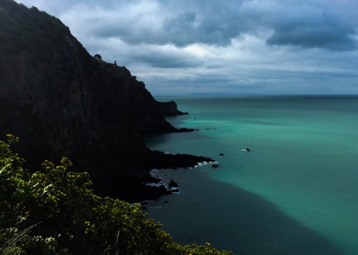
This short walk once followed the cliff edge all the way to Sumner. During the February 2011 earthquakes, extensive cliff collapse meant that much of the track was lost. The track now runs up onto the headland between Taylors Mistake and Sumner, but no further.
This walk starts near the surf club buildings. There is a large car park here, playground and toilets. Take the road past the surf club down to some beachside houses. A small unmarked footpath heads off between the properties.
Follow this footpath past a turn-off leading down to the famous cave baches of Hobson Bay. Several of these appear to have severe earthquake damage. The track continues past the bay and around a partially revegetated headland.
Glimpsing the raw cliffs of Whitewash Head, the track heads easily up a grassy paddock onto the top of the cliffs. The old route ends here at a semi-temporary mesh fence blocking further clifftop access. Follow the path straight uphill to the road.