Monument Track (south)
- 1 hr one way
- Easy
Climb from the head of the Kaituna Valley to Te Ara Pātaka, and the network of tracks running from Purau Saddle, Mt Herbert and Port Levy Saddle.

|
Walking time
|
1 hr |
|---|---|
|
Distance
|
3.1km |
|
Type
|
One way
|
|
Grade
|
Easy
Gentle grade on an old vehicle track Grades explained
|
|
Bookings
|
No bookings — open access
No — open access
|
|
Starts
|
Road end, Kaituna Valley Road, Ataahua |
|---|---|
|
Ends
|
Te Ara Pātaka, the ridgeline between Mt Herbert and Port Levy Saddle |
|
Maps
|
NZTopo50-BX24
|
|
Altitude
|
212m
–
670m
Altitude change 458m
|
Monument Track from Head of Kaituna
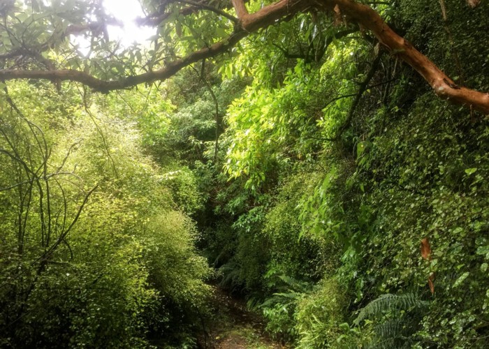
To get onto this track, you have to walk through what looks like someone’s yard. This section is shared by a few properties so it’s not as intrusive as it appears. It is a paper road. The route is marked with the occasional yellow topped waratah with some topped with red standards up where the track hits the ridge after a climb of 660 m.
The track goes through a section of native bush with plentiful fuschia. The berries (konini) were ripe when I went through on 21 February. There are some lovely stands of ferns in this section, particularly blechnum fluviatile (kiwa kiwa).
Evenutually directly below Pt 764, the track crosses a little rivulet draining an area of scrub where animals would seldom stray. I chanced it here for a drink of clear cool water. The track does a second zig and heads up to a junction which signals with 3 markers to carry on NNE to the ridgeline.
From here the track sidles around the ridgeline and down towards Monument Hut. You can leave Monument Track to climb up to Mt Herbert to the west. Alternatively you can follow the summit track south-east to Port Levy Saddle.