Camp Saddle / Lyndon Saddle Circuit
Craigieburn Forest Park
- 3 hr 20 min loop track
- Medium
-
Broken River Ski Area Road, Lyndon Saddle Track to Camp Saddle Track: 40 minutes
-
Camp Saddle Track, road to Camp Saddle: 1 hour
-
Camp Saddle to Lyndon Saddle: 1 hour
-
Lyndon Saddle Track, Lyndon Saddle to road: 40 minutes
- Helicopter Hill Summit (1256m): 40 minutes return. Follow the marked trail from Lyndon Saddle.
A day walk loop in the Craigieburn Ranges, leading from beech forest through tussocks and onto alpine rock and scree fields.
|
Walking time
|
3 hr 20 min |
|---|---|
|
Distance
|
10.1km |
|
Type
|
Loop track
|
|
Grade
|
Medium
Unmarked alpine route with several misleading spurs. Steep scree travel. Avalanche paths cross the track. Grades explained
|
|
Bookings
|
No bookings — open access
No — open access
|
|
Starts
|
Lyndon Saddle Track sign on the Broken River Skifield Road, off SH73. |
|---|---|
|
Maps
|
NZTopo50-BW21
|
|
Altitude
|
880m
–
1,550m
Altitude change 670m
|
This circuit combines two tracks with a route and a pleasant bush road walk to make an interesting day walk. A number of variations are possible: up and back on the Camp Saddle Track, or crossing the saddle to descend along the Craigieburn Valley Track are both easier options. The tracks are all marked, with the exception of the section from Camp Saddle down the spur to the treeline. The clockwise circuit described here is easier due to the scree section.
A number of interesting scree plants are observed on the open spur between the two saddles, including penwiper and Stellaria roughii. Scree plants are often rock grey, making them almost invisible.
The Lyndon Saddle Track is commonly used by mountain bikes, so watch for traffic and share the track.
From SH73, turn off at the sign for Broken River Ski Area and follow the road to the marked Lyndon Saddle Track. Park here if there is room or park further up the road.
Broken River Ski Area Road
Follow the road under beech forest, past a junction. Eventually you will come to a locked gate at a bridge. Continue past this to the grader shed. The Camp Saddle Track sets off on the right.
Camp Saddle Track
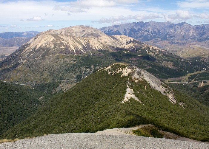
A wide and evenly graded track climbs gently under trees. It bends around a spur and switches back a couple of times before breaking out into tussock and scree. The poled track continues easily to the saddle (1490m). Over the saddle are views of the Craigieburn Ski Area.
Camp Saddle to Lyndon Saddle
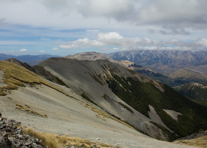
This section is largely unmarked, with several misleading spurs. Climb the small hill to the right. This is the track high point at 1550m. From here, continue eastward along the rolling spur (don't turn off to the south on the descending spur here). The spur varies between rocky outcrops and shattered rock, but is mostly straightforward travel.
Eventually, a second high point is reached on the spur (marked on the map at 1525m). Up here, there are good views of Purple Hill to the east and Broken Hill to the southeast. Broken Hill is distinctly yellow, and is a good indicator of the direction of travel, along with the small knob that is Helicopter Hill.
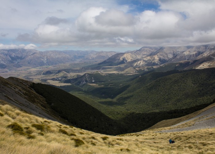
Keeping sight of Helicopter Hill, drop off the spur to the true left when it starts to bend away to the southwest. A minor spur leads off to the left here, and there should be a long scree run with forest at the foot between the main spur and the minor spur. Drop down the scree, keeping generally left, and pick up a foot trail at the bottom. This trail leads leftward onto the minor spur at the treeline. Markers indicate a trail down through beech forest to Lyndon Saddle (the uphill route from Lyndon Saddle is not obviously marked).
Lyndon Saddle Track
From Lyndon Saddle (1150m), tracks lead off in five different directions. Take the marked Lyndon Saddle Track down to the right. This is an easy rolling track, rather scoured out by mountain bikes. It drops gently through beech forest, hanging with mistletoe, and comes out at a stream by the road.