Charming Creek Walkway
- 2 hr 30 min – 3 hr one way
- Easy
One of Buller's longer established walkways that is also open to mountain bikers.
The majority of the 10.5 km route follows an old railway formation. The route is littered with historic sawmilling and coalmining relics.
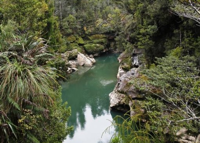
The lower Ngakawau gorge section is spectacular and it was a major engineering feat when the railway was put through this rugged area in the early 1900's by a local sawmiller.
|
Walking time
|
2 hr 30 min – 3 hr |
|---|---|
|
Distance
|
10.5km |
|
Type
|
One way
|
|
Grade
|
Easy |
|
Bookings
|
No bookings — open access
No — open access
|
|
Starts
|
Ngakawau NZTM2000 E1506707 N5392988 |
|---|---|
|
Ends
|
Charming Ck Road NZTM 2000 E1513070 N5395744 |
|
Maps
|
NZTopo50-BR21
|
|
Altitude
|
5m
–
130m
Altitude change 125m
|
|
Link
|
www.doc.govt.nz/parks-and-recreation/tracks-and-walks/west-coast/buller/charming-creek-walkway/http://www.doc.govt.nz/parks-and-recreation/tracks-and-walks/west-coast/buller/charming-creek-walkway/ |
|---|
See the DOC link.
ID 14526
About this track
31 views in the past year (3 per month).