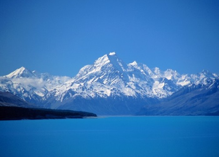
Aoraki / Mount Cook National Park
A climbers' park surrounding New Zealand's highest peak, Aoraki / Mount Cook, at 3754m. Mount Cook National Park is part of Te Wahipounamu World Heritage Area. The Copland Track is a classic crossing of Copland Pass (2 150m), leading from Mount Cook Village to the rich river valleys of the West Coast.
|
Area
|
707 square kilometres |
|---|---|
|
Established
|
1953 |
|
Maps
|
NZTopo50-BX15
|